Home
Garmin
GPS
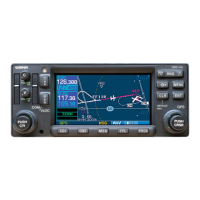
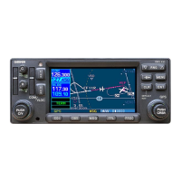
GNS 530
Garmin GNS 530 Pilot's Guide & Reference
5
of 1
of 1 rating
288 pages
Give review
Manual
Specs
To Next Page
To Next Page
Loading...
G
NS
530(A)
Pilot’
s
Guide
and
Reference
2
Table of Contents
Default Chapter
5
Table of Contents
5
Warnings, Cautions, and Notes
7
Accessories and Packing List
11
Standard Package
11
Section 1: Introduction
11
Key and Knob Functions
12
Left-Hand Keys and Knobs
13
Right-Hand Keys and Knobs
13
Bottom Row Keys
14
Blank Direct-To Page
14
Scroll Bar
14
Takeoff Tour
15
Overview
15
Powering up the GNS 530
15
Acknowledging the Database Information
16
Instrument Panel Self-Test Page
16
Entering Fuel Capacity, Fuel on Board, or Fuel Flow Figures (if Not Provided by Sensors)
16
Setting Fuel on Board to Full
17
Viewing the Checklists Page
17
Fuel Flow Selected
17
Satellite Status Page
18
Viewing a System Message
18
Returning to the Previous Page after Viewing a Message
18
Selecting COM and VLOC Frequencies
19
Changing the Standby Communication Frequency
19
Placing the Standby Communication Frequency in the Active Field
19
Changing the Standby VLOC Frequency
19
Page Groups
20
Selecting the Desired Page Group and Page
20
NAV Pages
20
Selecting the Desired NAV Page
20
Map Page
21
Direct-To Navigation
21
Selecting a Direct-To Destination
21
Default NAV Page
22
Selecting the Default NAV Page
22
Changing the Data Fields
23
NAV/COM Page
23
Displaying the Frequency List for the Desired Flight Plan or Direct-To Airport
23
Selecting a Communication or Navigation Frequency
24
Displaying Frequencies for a Different Airport Along the Flight Plan
24
IFR Procedures
25
Selecting an Approach, Departure, or Arrival
25
Procedures Page
25
Approach Window
25
Nearest (NRST) Pages
26
Displaying the NRST Pages
26
Displaying a List of Nearby Airports
26
Selecting a Nearby Airport as a Direct-To Destination from the Nearest Airport Page
27
Selecting a Nearby Airport as a Direct-To Destination from an Airport Information
27
Nearest (NRST) Airspace Page
28
Viewing an Airspace Alert Message
28
Viewing Additional Airspace Information
28
Flight Plans (FPL)
29
Creating a New Flight Plan
29
Activating the New Flight Plan
30
Communicating Using the GNS 530
31
Overriding the Automatic Squelch
31
COM Window and Tuning
31
Section 2: Com
31
Selecting a COM Frequency
32
Standby Frequency of 135.325
32
Active Frequency of 135.325
32
Auto-Tuning
33
Selecting a COM Frequency for a Nearby Airport
33
Displaying the Entire List of Frequencies for a Nearby Airport and Selecting from that List
33
Selecting a COM Frequency for a Nearby Flight Service Station (FSS) or Center
34
Selecting a COM Frequency for any Airport in the Flight Plan
34
Emergency Channel
35
Quickly Tuning and Activating 121.500
35
Selecting a COM Frequency for any Airport in the Database
35
Stuck Microphone
36
Main Page Groups
37
Section 3: Nav Pages
37
Default NAV Page
38
Nav Page Group
38
Selecting Desired On-Screen Data
40
Auto Zoom
41
Dual Unit Considerations
41
Restoring Factory Settings
41
Map Page Symbols
42
Selecting a Map Range
42
Detail Level on Map Page
43
Overzoom on Map Page
43
Information for On-Screen Waypoint
44
Map Panning
44
Reviewing Information for an On-Screen Airport, NAVAID or User Waypoint
44
Selecting the Panning Function and Panning the Map Display
44
+MAP Waypoint
45
Airspace Information on the Map
45
Map Direct-To
45
Select Airspace with Target Pointer
45
Displaying the Map Page Menu
46
Map Setup
46
Changing the Map Orientation
47
To Enable/Disable Automatic Zoom
47
Enabling/Disabling the Wind Vector, All Background Land Data, or All Jeppesen Aviation Data
48
Adding Data Fields to the Map
49
Distance Measurements
49
Clearing On-Screen Weather Data
50
Restoring the Factory Default Settings
50
Selectable Display Settings
51
Terrain Page
51
Changing the Display Range
52
Displaying a 120 View
52
Showing or Hiding Aviation Data
52
Inhibit Mode
53
Terrain Symbols
53
Taws Page
54
Enabling TAWS
55
Inhibiting TAWS
55
TAWS Manual Test
56
TAWS Symbols
56
NAV/COM Page
57
Scrolling through the List of Frequencies
58
Satellite Status Page
59
GPS Receiver Status Messages
60
Re-Centering the CDI (HSI) Needle to the same Destination Waypoint
61
Section 4: Direct-To Navigation
61
Overview
61
Selecting a Destination by Facility Name or City
62
Selecting a Direct-To Destination by Facility Name or City
62
Selecting a Destination from the Active Flight Plan
63
Selecting the Nearest Airport as a Direct-To Destination
64
Shortcuts
64
Selecting a Direct-To Destination from the Map Page
65
Cancelling Direct-To Navigation
66
Specifying a Course to a Waypoint
66
Flight Plan Catalog Page
67
Section 5: Flight Plans
67
Flight Plan Editing
68
Changing the Comment Line for an Existing Flight Plan
69
Deleting a Waypoint from an Existing Flight Plan
69
Activating an Existing Flight Plan
70
Activating Flight Plans
70
Inverting Flight Plans
70
Copying Flight Plans
71
Deleting Flight Plans
71
Crossfilling Flight Plans between Two 400-Or 500-Series Garmin Units
72
Flight Plan Catalog Options
72
Deleting All Flight Plans
73
Active Flight Plan Options
74
Active Flight Plan Page
74
Active Flight Plan Page Menu Options
75
Activating a Flight Plan Along a Specific Leg
76
Changing a Data Field on the Active Flight Plan Page
76
Restoring Factory Default Settings for Data Fields on the Active Flight Plan Page
76
Selecting an Approach for a Direct-To or Flight Plan Destination Airport
77
Selecting a Departure for the Departure Airport
78
Selecting an Arrival for a Direct-To or Flight Plan Destination Airport
78
Determining the Closest Point, Along the Active Flight Plan, to a Selected Waypoint
79
Removing an Approach, Arrival, or Departure from the Active Flight Plan
79
Removing a Waypoint Using the CLR Key
80
Activating a Specific Leg of the Active Flight Plan
81
Approaches, Departures, and Arrivals
83
Section 6: Procedures
83
Activating an Approach
84
Activating the Approach, with Vectors to Final
85
Non-Precision Approach Operations
85
Approaches with Procedure Turns
86
Flying the Procedure Turn
88
Sample Approach with Procedure Turn
88
Terminal Annunciator
88
Sequence to Inbound Leg
89
Terminal Mode
89
Waypoint Alert
89
Flying the Missed Approach
90
Sequence to MAP
90
‘SUSP’ Annunciation
90
‘Hold Teardrop’ Annunciation
91
Flying an Approach with a Hold
92
TRANS ‘Transitions’ Window
92
Flying a DME Arc Approach
95
Enroute Mode
96
Select Waypoint Page
96
Message Window
97
Flying the Vectors Approach
100
Course from Fix Flight Plan Legs
102
KPMD Approach
102
Waypoint Alert, Default NAV Page
103
Waypoint Alert, Map Page
103
Palmdale Missed Approach
104
Coastal One Departure
106
GPS and VLOC Annunciations
107
ILS Approaches
107
Selecting an ILS Approach
108
Flying the ILS Approach
110
Alert Message
111
ILS Approach Course
111
Switches to VLOC
111
Points to Remember for All Approaches
114
Points to Remember for Localizer-Based Approaches
114
Quickly Selecting a WPT Page
117
WPT Page Group
117
Section 7: Wpt Pages
117
Entering a Waypoint Facility Name or City Location
118
Entering a Waypoint Identifier
118
Duplicate Waypoints
119
Selecting a Facility Name or Location Where Duplicate Entries Exist
119
Airport Location Page
120
Selecting a Waypoint Identifier from a List of Duplicates
120
Airport Location Page Options
121
Selecting an Airport Location Page Menu
121
Airport Runway Page
122
Adjusting the Range of the Map Image
123
Airport Runway Page Options
123
Selecting an Airport Runway Page Menu
123
Airport Frequency Page
124
Airport Approach Page
126
Airport Frequency Page Options
126
Airport Approach Page Options
127
Airport Arrival Page
128
Loading an Approach from the Airport Approach Page
128
Scrolling through the Available Arrivals
128
Airport Arrival Page Options
130
Airport Departure Page
130
Loading an Arrival Procedure from the Airport Arrival Page
130
Scrolling through the Available Departures
130
Airport Departure Page Options
131
Intersection Page
132
NDB Page
132
VOR Page
133
Creating User Waypoints
134
User Waypoint Page
134
Capture and Save Present Position
136
Creating User Waypoints from the Map Page
136
Modifying a User Waypoint by Changing Reference Waypoint Information
137
Modifying User Waypoints
137
User Waypoint Page Options
138
Viewing a List of All User Waypoints
138
Deleting a User Waypoint
139
User Waypoint List
139
Deleting a User Waypoint from the User Waypoint List
140
Renaming a User Waypoint from the User Waypoint List
140
Deleting All User Waypoints from Memory
141
NRST Page Group
143
NRST Pages
143
Quickly Selecting a NRST Page
143
Section 8: Nrst Pages
143
Nearest Airport Page
145
Navigating to a Nearby Waypoint
145
Quickly Tuning the Common Traffic Advisory Frequency (CTAF) from the Nearest Airport Page
146
Additional Communication Frequencies, Runway
146
Nearest Intersection Page
147
Nearest NDB Page
148
Nearest vor Page
148
Nearest User Waypoint Page
150
Nearest Center (ARTCC) Page
150
Nearest Flight Service Station (FSS) Page
151
Nearest Flight Service Station (FSS) Page
152
Nearest Airspace Page
153
VLOC Receiver
157
VLOC (Vor/Localizer/Glideslope) Receiver Operations
157
Ident Audio and Volume
157
VLOC Window and Tuning
157
Section 9: Vloc Receiver
157
VLOC Ident Window
158
To Select an Approach and Automatically Tune the Proper VLOC Frequency
159
Tuning the VLOC When an Approach Is Active
159
CDI Key
160
AUX Page Group
161
Quickly Selecting an AUX Page
161
Section 10: Aux Pages
161
Flight Planning Page
162
Flight Planning Page: Fuel Planning
164
Flight Planning Page: Trip Planning
165
Flight Planning Page: Density Alt/Tas/Winds
166
Flight Planning Page: Scheduler
167
Editing a Scheduled Message
168
Deleting a Scheduled Message
168
Flight Planning Page: Crossfill
168
Utility Page
170
Utility Page: Checklists
172
Creating a Checklist
172
Executing a Checklist
173
Editing a Checklist
173
Deleting a Checklist or All Checklists
173
Inserting a Checklist Step into an Existing Checklist
173
Utility Page: Flight Timers
174
Copying a Checklist
174
Sorting the Checklists by Name or Entry
174
Recording or Resetting the Departure Time
175
Viewing, Using, or Resetting Total Trip Time
175
Utility Page: Trip Statistics
176
Utility Page: RAIM Prediction
176
Resetting Trip Statistics Readouts
176
Predicting RAIM Availability
176
Utility Page: Software Versions
177
Utility Page: Database Versions
177
Setup Page
178
Utility Page: Terrain Database Versions
178
Selecting a Menu Option from the Setup
179
Setup Page: CDI/Alarms
181
Setup Page: CDI Scale/Alarms
182
Changing the ILS CDI Scale
183
Setting the Arrival Alarm and Alarm Distance
183
Setup Page: Units/Position
184
Changing the Units of Measure
184
Changing the Position Format
185
Displaying the Map Datum
185
Setup Page: Date/Time
186
Displaying Local Time or UTC
186
Setting the Local Time
186
Setup Page: Display Backlight
187
Changing the Backlighting Intensity
187
Setup Page: Nearest Airport Criteria
187
Setting the Minimum Runway Length and Runway Surface
187
Setup Page: Data Field Configuration
188
Configuring the Auxiliary Data Field
188
Setup Page: COM Configuration
189
Setting the COM Channel Spacing
189
Displaying the Vertical Navigation Page
191
Section 11: Vertical Navigation (Vnav)
191
Creating a Vertical Navigation Profile
192
Disabling/Enabling the Vertical Navigation (VNAV) Messages
194
Restoring the Factory Default VNAV Settings
194
Operating Criteria
195
Limitations
195
Section 12: Terrain
195
Introduction
195
TERRAIN Alerting
196
Baro-Corrected Altitude
196
Using TERRAIN
196
Terrain Altitude/Color Correlation
197
Terrain/Obstacle Colors and Symbology
197
TERRAIN Page
197
Terrain Alerts
198
TERRAIN Annunciation Field
198
TERRAIN Advisory Pop-Up
198
TERRAIN Caution Pop-Up (Flashing)
198
TERRAIN Alert Summary
199
Forward Looking Terrain Avoidance
200
Additional System Annunciations
200
Minimum Terrain and Obstacle Clearance Values for FLTA Alerts
200
Premature Descent Alerting
201
TERRAIN Inhibit
201
Inhibiting TERRAIN
201
Enabling TERRAIN
201
Terrain Not Available Alert
202
Terrain Failure Alert
202
Database Information for TERRAIN
203
General Database Information
203
Database Versions
203
Database Updates
204
Updating Terrain/Obstacle Databases
204
Terrain/Obstacle Database Areas of Coverage
204
TAWS Alerting
205
Section 13: Taws
205
Introduction
205
Using TAWS
206
Terrain Altitude/Color Correlation for TAWS
207
TAWS Terrain/Obstacle Colors and Symbology
207
TAWS Page
207
TAWS Alerts
208
TAWS Annunciation Field
208
Warning Alert Pop-Up
208
TAWS Alerts Summary
209
Excessive Descent Rate Alert
212
Negative Climb Rate after Takeoff Alert (NCR)
213
'Five-Hundred' Aural Alert
214
Taws Failure Alert
214
Database Information for TAWS
215
Traffic Information Service (TIS) Interface
217
Section 14: Additional Features
217
TIS Coverage Volume
218
TIS Limitations
218
TIS Operational Procedures
218
TIS Audio Alerting
220
TIS Symbology
220
Traffic Page
221
TIS Traffic Display Status and Pilot Response
222
Traffic Warning Window
223
Non-Bearing Traffic Advisory (TA) Banner
224
Traffic Page Display Range
224
Configuring TIS Traffic on the Map Page
225
Thumbnail Traffic on Map Page
225
Highlighting TIS Traffic Using Map Page Planning
226
Power-Up Test
226
After Landing
227
Flight Procedures
227
Manual Override
227
GTS 8XX Traffic Systems
228
TA Alerting Conditions
229
TA Sensitivity Level and TA Alerting Criteria
229
TCAS I Surveillance Volume
229
Traffic Symbology
229
Aural Alerts
230
Self-Test
230
User-Initiated Test
230
Switching between Standby and Operating Modes
231
Switching to Standby Mode from the Traffic Page
231
Altitude Display Mode
232
Changing the Altitude Display Mode
232
Configuring Traffic Data on the Map Page
233
Map Page Traffic Banner
233
Highlighting Traffic Data Using Map Panning
234
Weather Data Link Interface
235
NEXRAD Abnormalities
236
NEXRAD Description
236
NEXRAD Limitations
236
Weather Products
236
NEXRAD Intensity
237
NEXRAD Intensity Colors
237
Requesting NEXRAD Data
238
Data Received Message
239
Requesting NEXRAD Data from the Map Page
239
Customizing NEXRAD Data on the Weather Page
240
Displaying NEXRAD Data on the Weather Page
240
Customizing NEXRAD Data on the Map Page
241
Displaying NEXRAD Data on the Map Page
241
Request Shortcuts
242
Data Link Request Log Page
243
Sending Position Reports
243
Viewing the Data Link Request Log Page
243
Requesting Graphical METARS
244
Displaying Graphical METARS on the NAV Weather Page
246
Requesting Graphical or Textual METARS from the Map Page
246
Displaying the Weather Legend
247
Weather Legend Page
247
Displaying Temperature/Dewpoints
248
Displaying Wind Data
248
Entering an Identifier
248
Selecting the METARS Text Page
248
Monitoring the Data Link
249
Troubleshooting
249
View the Data Link Status Page
249
Sat ID/Connectivity Field
250
SATCOM Operation Field
250
Standard Aviation Forecast Abbreviations
251
METAR Graphics
252
Metars
252
Gust Offset Graphics
253
Wind Speed Graphics
253
Wind Symbol
253
Winds
253
Temperature - Dewpoints
254
Fault Detection and Exclusion
255
SECTION 15: FAULT DETECTION and EXCLUSION
255
Pre-Departure Verification of FDE
256
Garmin 500 Series Trainer Software
256
SECTION 16: MESSAGES, ABBREVIATIONS, and NAV TERMS
257
Abbreviations
265
Navigation Terms
268
Illustrated NAV Terms
268
Illustrated Vertical NAV Terms
268
To Insert the Navdata or Terrain Data Card
271
Data Card Slot Locations
271
Data Card Insertion/Removal Detail
271
Appendix Adata Card Use
271
To Remove the Navdata or Terrain Data Card
272
Appendix B: Specifications
273
What Is RAIM, and How Does It Affect Approach Operations?
275
Why Aren’t There any Approaches Available for My Flight Plan?
275
Appendix C: Troubleshooting Q & a
275
What Happens When I Select an Approach?
276
Can I File Slant Golf (‘/G’) Using My GPS?
276
What Does the OBS Key Do and When Do I Use It?
276
When Should I Use the OBS Key to Return to Auto Sequencing, and What Happens When I Do?
278
How Do I Skip a Waypoint in an Approach, Departure or Arrival?
278
Why Won’t My Unit Automatically Sequence to the Next Waypoint?
278
How Do I Fly the GPS with an Autopilot and DG Heading Bug?
278
When Does Turn Anticipation Begin, and What Bank Angle Is Expected?
279
When Does the CDI Scale Change, and What Does It Change To?
279
Why Does My CDI Not Respond Like a vor When OBS Mode Is Active?
280
What Is the Correct Missed Approach Procedure? How Do I Select the Missed Approach Holding Point?
280
How Do I Re-Select the same Approach or Activate a New Approach after a Missed Approach?
280
Index
281
Other manuals for Garmin GNS 530
Manual
35 pages
Pilot's Guide And Reference
282 pages
Quick Reference
22 pages
Brochure
1 page
5
Based on 1 rating
Ask a question
Give review
Questions and Answers:
Need help?
Do you have a question about the Garmin GNS 530 and is the answer not in the manual?
Ask a question
Garmin GNS 530 Specifications
General
Power Supply
14/28 VDC
Operating Temperature
-20°C to +55°C
Display Type
LCD
Screen Size
5 inches
GPS Receiver
12-channel
Dimensions
6.25 inches
Interfaces
RS-232
Related product manuals
Garmin GNS 530W
230 pages
Garmin GNS 530AW
236 pages
Garmin GNS 430
27 pages
Garmin GNS 480
200 pages
Garmin GNS 400W
220 pages
Garmin GNS 430W
232 pages
Garmin GNS 430 AW
212 pages
Garmin GNS 400W Series
114 pages
Garmin GNC 355
290 pages
Garmin GNX 375
290 pages
Garmin GNC 300XL
59 pages
Garmin GPS 400W,GNC 420W
232 pages