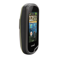
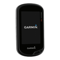
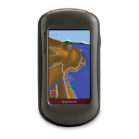
1
camera lense
(not applicable)
2
Power button
3
Battery cover
D-ring
4
User key
5
Card slot
(under cover)
6
USB port
(under cap)
Garmin Oregon 600t Global Positioning
System (GPS) quick-start guide
Installing the batteries and turning on
the device
1. Remove the belt clip by pulling up on
the clip (so the end of the clip moves away
from the body of the GPS) while
simultaneously pulling the entire clip
downwards along the body of the GPS
towards the lanyard hole.
2. Rotate the small metal D-ring anti-
clockwise to remove the cover.
3. Install batteries, ensuring correct
orientation, and note battery type.
4. Replace the cover, lower end first.
5. Press the power button on the right hand
side of the unit.
Ensure that the GPS is set up to use
whichever kind of battery you're using:
> Setup > System > AA
Battery Type > Alkaline
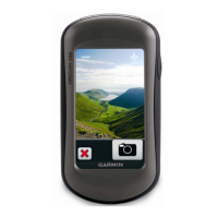
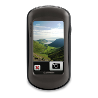
Using the touchscreen
Tap the screen to click/select an item Drag
or swipe across the screen to pan or scroll
Pinch two fingers together to zoom out
Spread two fingers apart to zoom in
Tap
to save changes & close page
Tap
to close the page
Tap
to return to the previous page
Hold
to return to the main menu
Tap
to see specific menu items for the
page you were viewing
Swipe
up or down to see
more menu option
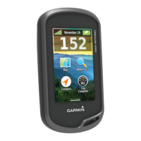
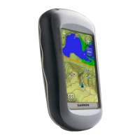
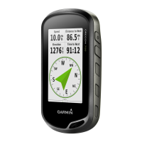
Home screen
Map shows a map of the area
Where to? allows you to select waypoints
Compass displays a your current
location, distance and bearing to the next
waypoint, and and your average speed
Trip computer displays other movement
information
Setting the correct map datum
1. Select Setup (may need to swipe
)
2. Scroll down to select Position Format
3. Select Map Datum:
4. Choose GDA94 for Victoria Police
maps and any map displaying
the GDA logo shown at right:
5. Choose Aus Geod '66 for older maps
6. Tap
and then to save.
The GPS should already be set up to use
UTM/UPS coordinates, metric units, and
magnetic bearings
___________________________________
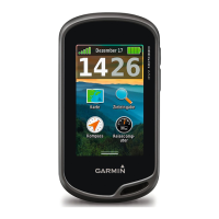
Reporting your current location
1. Briefly press the User button. This will
display your current coordinates.
2. To give a routine location in a radio
message, or in general discussion, a 6
figure grid reference plus description is
used. Report a description of your
location followed by the red numbers, as
shown:
Location
55H 0357179
UTM 5826488
3. For example: "BSAR 6 is at the creek
junction at grid reference 571264." You
can then press Cancel, or alternatively
enter a name for this waypoint and then
Save it.
4. A full 14-digit grid reference is only
warranted in a radio message with a
'search-critical' location; for example,
"BSAR 4 has found the missing person at
55H 0357179 5826488".