Do you have a question about the Lowrance 12 and is the answer not in the manual?
| GPS | Yes |
|---|---|
| Sonar | Yes |
| CHIRP Sonar | Yes |
| CHIRP DownScan | Yes |
| CHIRP SideScan | Yes |
| NMEA 2000 | Yes |
| Water Resistance | IPX7 |
| Resolution | 1280 x 800 |
| Screen Size | 12 inches |
Details on using batteries and external power sources for the unit.
Information on battery types, recommendations, and installation procedures.
Step-by-step guide for correctly installing batteries into the unit.
Specific instructions for the NiMH rechargeable battery and its charger.
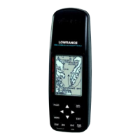
Description of each key and its function on the unit's keypad.
Explanation of how to navigate and use the unit's intelligent menu system.
Details the automatic process for finding and locking onto GPS satellites.
Details the graphical navigation screen with compass and track information.
Description of the basic plotter screen showing present position and trail.
Details the plotter screen with added navigation data fields.
How to configure the plot trail update rate and method (time/distance).
Procedure for erasing the recorded plot trail from the screen.
Instructions on enabling and disabling the plot trail recording feature.
Step-by-step process to place a selected icon at the current location.
Details the data fields displayed in the Group A window layout.
Describes the data fields in Group B, including ETE and CDI.
The primary menu for accessing all waypoint functions.
Simple method to save the current position as a new waypoint.
Selecting a waypoint by its assigned number.
Selecting a waypoint from a list of all saved locations.
Selecting the waypoint closest to the current position.
Direct navigation to a point on the plotter without saving it as a waypoint.
Transferring waypoint data from one number to another for organization.
Adjusting the display's backlight for visibility and power saving.
Enabling and setting up the unit to transmit NMEA data to other devices.
Specifying NMEA 0183 version and data sentence types.
Settings for connecting and utilizing compatible DGPS receivers.
Changing how position coordinates are displayed (e.g., DMS, UTM).
Setting a specific waypoint as the starting point for the simulator.