Table of Contents
Introduction.....................................................................1
Setting Up the System................................................................ 1
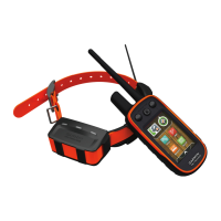
Device Overviews....................................................................... 1
Alpha 50 Handheld Device.................................................... 1
Keypad................................................................................... 1
Dog Collar Device.................................................................. 1
Installing Batteries...................................................................... 1
Charging the Dog Collar Device................................................. 1
Turning On the Devices.............................................................. 2
Turning Off the Devices.............................................................. 2
Acquiring Satellite Signals.......................................................... 2
Adjusting the Backlight Brightness............................................. 2
Fitting the Collar on Your Dog.................................................... 2
Using the On-Screen Keyboard.................................................. 2
Dog Tracking.................................................................. 2
Tracking Your Dog on the Map................................................... 2
Navigating to Your Dog...............................................................2
Viewing Dog Status................................................................3
Dog Status Icons....................................................................3
Location Alerts............................................................................ 3
Setting a Geofence Alert........................................................ 3
Setting a Radius Alert............................................................ 3
Editing Location Alerts........................................................... 3
Dog Information.......................................................................... 3
Hunt Metrics........................................................................... 3
Resetting a Dog's Statistics and Track.................................. 3
Changing the Length of the Dog's Track............................... 3
Changing a Dog Name.......................................................... 3
Changing the Color of the Dog's Track.................................. 3
Changing the Dog Type......................................................... 3
Setting Dog Alerts.................................................................. 4
Removing a Dog.................................................................... 4
Pairing a Dog Collar to the Alpha Device................................... 4
Adding a Dog Using the Track and Control Codes................ 4
Assigning a Dog ID Manually................................................. 4
Changing the Update Rate.................................................... 4
Communication with the Collar................................................... 4
Tracking with BaseCamp™ BaseStation.................................... 4
Waypoints, Routes, and Tracks.................................... 4
Waypoints................................................................................... 4
Marking Your Vehicle Location.............................................. 4
Marking Your Current Location.............................................. 5
Marking a Covey.................................................................... 5
Marking a Waypoint Using the Map....................................... 5
Navigating to a Waypoint....................................................... 5
Editing a Waypoint................................................................. 5
Moving a Waypoint on the Map............................................. 5
Repositioning a Waypoint to Your Current Location.............. 5
Increasing the Accuracy of a Waypoint Location................... 5
Projecting a Waypoint............................................................ 5
Deleting a Waypoint............................................................... 5
Routes........................................................................................ 5
Creating a Route.................................................................... 5
Navigating a Saved Route..................................................... 5
Editing a Route...................................................................... 5
Viewing the Active Route....................................................... 5
Reversing a Route................................................................. 5
Deleting a Route.................................................................... 6
Deleting All Routes................................................................ 6
Tracks......................................................................................... 6
Recording Track Logs............................................................ 6
Viewing the Elevation Plot of a Track.................................... 6
Viewing Details about the Track............................................ 6
Saving the Current Track
....................................................... 6
Marking a Location on a Saved Track................................... 6
Navigating to the Start of a Track.......................................... 6
Archiving a Track Manually.................................................... 6
Sending and Receiving Data Wirelessly..................................... 6
Sharing Dog Information........................................................ 6
Receiving Dog Information.....................................................6
Navigation....................................................................... 6
Map............................................................................................. 6
Enabling the Map Data Fields................................................ 7
Compass.....................................................................................7
Calibrating the Compass........................................................7
Navigating with the Bearing Pointer....................................... 7
Course Pointer....................................................................... 7
Find Menu................................................................................... 7
Finding a Waypoint by Name................................................. 7
Navigating with Sight 'N Go........................................................ 7
Viewing the Elevation Plot.......................................................... 7
Calibrating the Barometric Altimeter...................................... 7
Navigating to a Point on the Plot........................................... 7
Changing the Plot Type......................................................... 7
Trip Computer............................................................................. 7
Resetting the Trip Computer.................................................. 7
Applications.................................................................... 8
Setting a Proximity Alarm........................................................... 8
Calculating the Size of an Area.................................................. 8
Viewing the Calendar and Almanacs.......................................... 8
Setting an Alarm......................................................................... 8
Geocaches..................................................................................8
Downloading Geocaches Using a Computer......................... 8
Finding a Geocache............................................................... 8
Filtering the Geocache List.................................................... 8
chirp™....................................................................................8
Opening the Stopwatch.............................................................. 8
Satellite Page..............................................................................8
Changing the Satellite View................................................... 8
Turning Off GPS.................................................................... 9
Simulating a Location.............................................................9
Disabling Dog Data Broadcast....................................................9
Enabling Bark Detection............................................................. 9
Enabling Rescue Mode...............................................................9
VIRB® Remote........................................................................... 9
Customizing Your Device.............................................. 9
Customizing the Main Menu....................................................... 9
Customizing the Data Fields....................................................... 9
Profiles........................................................................................ 9
Creating a Custom Profile...................................................... 9
Editing a Profile Name........................................................... 9
Deleting a Profile....................................................................9
System Settings.......................................................................... 9
Dog Settings............................................................................... 9
Display Settings........................................................................ 10
Setting the Device Tones..........................................................10
Map Settings............................................................................. 10
Advanced Map Settings....................................................... 10
Tracks Settings......................................................................... 10
Changing the Units of Measure................................................ 10
Time Settings............................................................................ 10
Position Format Settings...........................................................10
Heading Settings...................................................................... 10
Altimeter Settings......................................................................10
Geocaching Settings.................................................................11
Routing Settings....................................................................... 11
Marine Map Settings................................................................. 11
Setting up Marine Alarms.....................................................11
Table of Contents i
 Loading...