Finding a Marine Service and Navigating to It
To nd a marine service from your current location:
1. From the Home screen, touch Where To?.
2. Touch the marine service category to which you want to navigate. The unit shows the list of the
50 nearest locations and the distance and bearing to each.
3. Touch the marine service item to which you want to navigate. A screen containing information
about the selected marine service appears.
4. Touch Navigate To > Go To. (Or, touch Guide To when using a preprogrammed BlueChart g2
Vision card to use Auto Guidance.)
5. Follow the colored line on the screen to the destination.
Navigating to a Destination on the Chart
To navigate to a destination on the chart:
1. From the Home screen, touch Charts > Navigation Chart.
2. Touch the point on the chart to where you want to navigate. A pointer ( ) marks the point.
3. Touch Navigate To.
4. Touch Go To to navigate directly to the location, or touch Route To to create a specic route to
the location.
5. Follow the line on the Navigation Chart to the destination.
Marking a Waypoint
To mark your current location as a waypoint:
1. From the Home screen, touch Mark.
2. Touch Edit Waypoint to designate a specic name, symbol, water depth, water
temperature, or position.
To create a new waypoint:
1. From the Home screen, touch Charts > Navigation Chart.
2. Touch the location you want to designate as a waypoint.
3. Touch Create Waypoint.
Navigation Chart
Create Waypoint Screen
Navigation Chart
Follow the Route
List of Marine Service Items
Go to Destination
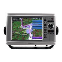
GPSMAP
®
5000 Series
quick reference guide
To edit a waypoint:
1. Touch the waypoint on the navigation chart.
2. Touch the button for the waypoint you want to
edit.
3. Touch Edit Waypoint.
4. Touch the waypoint attribute you want to change
(Name, Symbol, Depth, Water Temp, or
Position).
To delete a waypoint:
1. From the Home screen, touch Information >
User Data > Waypoints.
2. Touch the waypoint you want to delete.
3. Touch Delete.
Editing or Deleting a Waypoint
Edit or Delete a Waypoint