Locations
You can record and store locations in the device.
Marking Your Location
Before you can mark a location, you must locate satellites.
If you want to remember landmarks or return to a certain spot,
you can mark a location.
1
Go for a ride.
2
Select Where To? > > Mark Location > .
Saving Locations from the Map
1
Select Where To? > > Select Search Area > A Map
Point.
2
Browse the map for the location.
3
Select the location.
Location information appears at the top of the map.
4
Select the location information.
5
Select > .
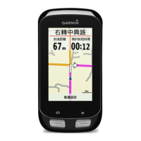
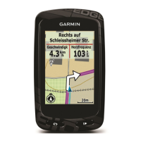
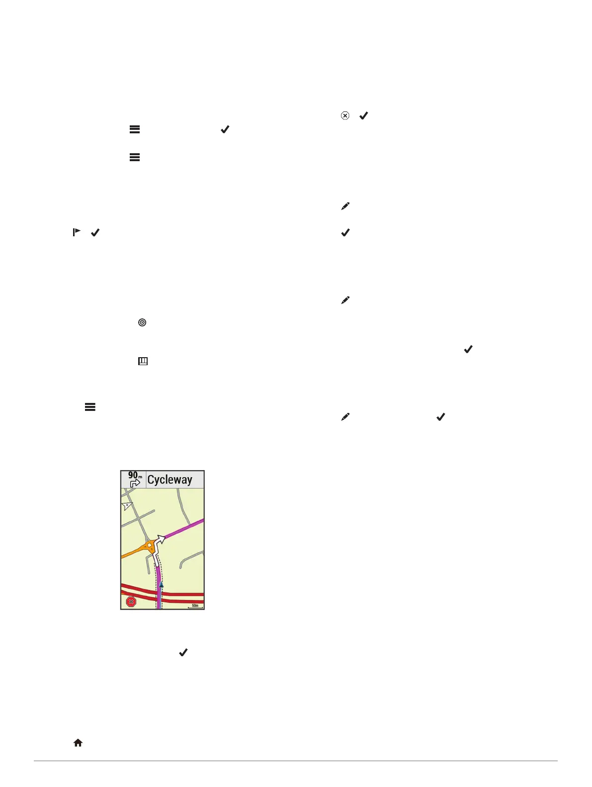
Navigating to a Location
1
Select Where To?.
2
Select an option:
• Select Browse Map to navigate to a location on the map.
• Select Search to navigate to a point of interest, city,
intersection, or known coordinates.
TIP: You can select to narrow your search area.
• Select Find Address to enter a specific address.
• Select Saved Locations to navigate to a saved location.
TIP: You can select to enter specific search
information.
• Select Recent Finds to navigate to one of the last 50
locations you have found.
• Select > Select Search Area to narrow your search
area.
3
Select a location.
4
Select Ride.
5
Follow the on-screen instructions to your destination.
Navigating to Known Coordinates
1
Select Where To? > Search Tools > Coordinates.
2
Enter the coordinates, and select .
3
Follow the on-screen instructions to your destination.
Navigating Back to Start
At any point during your ride, you can return to the starting point.
1
Go for a ride (Going for a Ride, page 2).
2
During your ride, select anywhere on the screen to view the
timer overlay.
3
Select > Where To? > Back to Start.
4
Select Along Same Route or Most Direct Route.
5
Select Ride.
The device navigates you back to the starting point of your
ride.
Stopping Navigation
1
Scroll to the map.
2
Select > .
Projecting a Location
You can create a new location by projecting the distance and
bearing from a marked location to a new location.
1
Select Where To? > Saved Locations.
2
Select a location.
3
Select the location information at the top of the screen.
4
Select > Project Location.
5
Enter the bearing and distance to the projected location.
6
Select .
Editing Locations
1
Select Where To? > Saved Locations.
2
Select a location.
3
Select the information bar at the top of the screen.
4
Select .
5
Select an attribute.
For example, select Change Elevation to enter a known
altitude for the location.
6
Enter the new information, and select .
Deleting a Location
1
Select Where To? > Saved Locations.
2
Select a location.
3
Select the location information at the top of the screen.
4
Select > Delete Location > .
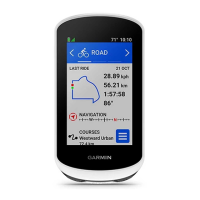
Courses
You can send a course from your Garmin Connect account to
your device. After it is saved to your device, you can navigate
the course on your device. You can also create and save a
custom course directly on your device.
You can follow a saved course simply because it is a good
route. For example, you can save and follow a bike-friendly
commute to work.
Planning and Riding a Course
You can create and ride a custom course. A course is a
sequence of waypoints or locations that leads you to your final
destination.
1
Select Courses > Course Creator > Add First Location.
2
Select an option:
• To select your current location on the map, select Current
Location.
• To select a saved location, select Saved, and select a
location.
• To select a location for which you recently searched,
select Recent Finds, and select a location.
• To select a location on the map, select Use Map, and
select a location.
• To browse for and select a point of interest, select POI
Categories, and select a nearby point of interest.
• To select a city, select Cities, and select a nearby city.
• To select an address, select Addresses, and enter the
address.
Navigation 3
 Loading...