2
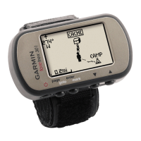
Select a waypoint.
3
Select OPTIONS > SEND.
Troubleshooting
Product Updates
On your computer, install Garmin Express
™
(www.garmin.com
/express). On your smartphone, install the Garmin Connect
Mobile app.
This provides easy access to these services for Garmin devices:
• Software updates
• Data uploads to Garmin Connect
• Product registration
Setting Up Garmin Express
1
Connect the device to your computer using a USB cable.
2
Go to www.garmin.com/express.
3
Follow the on-screen instructions.
Improving GPS Satellite Reception
• Frequently sync the device to your Garmin Connect account:
◦ Connect your device to a computer using the USB cable
and the Garmin Express application.
◦ Sync your device to the Garmin Connect Mobile app using
your Bluetooth enabled smartphone.
While connected to your Garmin Connect account, the device
downloads several days of satellite data, allowing it to quickly
locate satellite signals.
• Take your device outside to an open area away from tall
buildings and trees.
• Remain stationary for a few minutes.
Maximizing Battery Life
You can do several things to extend the life of the batteries.
• Use premium batteries.
• Reduce the backlight timeout (Device Settings, page 6).
• Turn off the beeper (System Settings, page 6).
• Turn off the compass when not in use (Device Settings,
page 6).
My device is in the wrong language
You can change the device language selection if you have
accidently selected the wrong language on the device.
1
From the menu page, select three times.
2
Select ENTER.
3
Select five times.
4
Select ENTER.
5
Select four times.
6
Select ENTER.
7
Select your language.
Resetting the Device
You can reset the device if it stops responding. This does not
erase any of your data or settings.
Hold POWER for 10 seconds.
Restoring All Default Settings
You can reset all settings back to the factory default settings.
From the menu page, select SETUP > RESET > RESTORE
DEFAULTS > YES.
Appendix
Data Fields
AMB PRESS: The uncalibrated ambient pressure.
AVG ASCENT: The average vertical distance of ascent since
the last reset.
AVG DESCNT: The average vertical distance of descent since
the last reset.
BAROMETER: The calibrated current pressure.
BEARING: The direction from your current location to a
destination. You must be navigating for this data to appear.
CADENCE: Cycling. The number of revolutions of the crank
arm. Your device must be connected to a cadence accessory
for this data to appear.
COURSE: The direction from your starting location to a
destination. Course can be viewed as a planned or set route.
You must be navigating for this data to appear.
ELEVATION: The altitude of your current location above or
below sea level.
FINAL DEST: The last point on the route or course.
FINAL DIST: The remaining distance to the final destination.
You must be navigating for this data to appear.
FINAL ETA: The estimated time of day when you will reach the
final destination (adjusted to the local time of the destination).
You must be navigating for this data to appear.
FINAL ETE: The estimated time remaining until you reach the
final destination. You must be navigating for this data to
appear.
GLIDE RATIO: The ratio of horizontal distance traveled to the
change in vertical distance.
GR DEST: The glide ratio required to descend from your current
position to the destination elevation. You must be navigating
for this data to appear.
HEADING: The direction you are moving.
HEART RATE: Your heart rate in beats per minute (bpm). Your
device must be connected to a compatible heart rate monitor.
MAX ASCENT: The maximum rate of ascent in feet per minute
or meters per minute since the last reset.
MAX DESCNT: The maximum rate of descent in meters per
minute or feet per minute since the last reset.
MAX ELEVTN: The highest elevation reached since the last
reset.
MAX SPEED: The highest speed reached since the last reset.
MAX TEMPE: The maximum temperature recorded in the last
24 hours from a compatible temperature sensor.
MIN ELEVTN: The lowest elevation reached since the last reset.
MIN TEMPE: The minimum temperature recorded in the last
24 hours from a compatible temperature sensor.
MOV'N AVG: The average speed while moving for the current
activity.
MOV'N TIME: The total time moving for the current activity.
NEXT DEST: The next point on the route. You must be
navigating for this data to appear.
NEXT DIST: The remaining distance to the next waypoint on the
route. You must be navigating for this data to appear.
NEXT ETA: The estimated time of day when you will reach the
next waypoint on the route (adjusted to the local time of the
waypoint). You must be navigating for this data to appear.
NEXT ETE: The estimated time remaining until you reach the
next point in your route. You must be navigating for this data
to appear.
Troubleshooting 9
 Loading...