4
Select an option:
• To begin navigating the current track, select GO.
• To mark a waypoint, select MARK.
• To zoom in and out using or , select ZOOM.
• To navigate back to the beginning of your activity, select
TRACBACK.
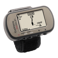
Viewing Track Details
1
From the menu page, select TRACKS > LIST SAVED.
2
Select a track.
3
Select an option.
• To view the track on the map, select SHOW MAP.
• To view an elevation plot of the track, select ELEVATION.
Editing the Name of a Track
1
From the menu page, select TRACKS > LIST SAVED.
2
Select a track.
3
Select RENAME.
Clearing the Active Track
From the menu page, select TRACKS > CLEAR TRACK >
YES.
Deleting a Track
1
From the menu page, select TRACKS > LIST SAVED.
2
Select a track.
3
Select DELETE > YES.
Deleting All Tracks
From the menu page, select TRACKS > DELETE ALL
SAVED > YES.
Customizing Your Device
Adjusting the Backlight Timeout
You can decrease the backlight timeout to maximize the battery
life.
1
From the menu page, select SETUP > DISPLAY > LIGHT
TIMEOUT.
2
Select or to adjust the length of time before the
backlight turns off.
Map Settings
From the map page, select ENTER.
PAN TRACK LOG: Allows you to use or to pan the track
log and view additional options. From the track log page, you
can select ENTER to go to a waypoint, mark a waypoint, or
zoom in and out.
CLEAR TRACK LOG: Deletes the recorded track log.
MEASURE DISTANCE: Allows you to measure the distance
between two waypoints (Measuring the Distance Between
Two Waypoints, page 3).
MAP DETAIL: Sets map preferences (Map Detail Settings,
page 4).
HIDE STATUS INFO: Allows you to hide and show the status
icons on the map page, such as battery level and GPS
status.
Map Detail Settings
From the map page, select ENTER > MAP DETAIL.
MAP ORIENTATION: Adjusts how the map is shown on the
page. The NORTH UP option shows north at the top of the
page. The TRACK UP option shows your current direction of
travel toward the top of the page.
ACTIVE TRACK: Shows or hides the active track on the map.
WAYPOINTS: Shows or hides waypoints on the map.
Compass Settings
From the compass page, select ENTER.
CALIBRATE COMPASS: Calibrates the electronic compass
(Calibrating the Compass, page 4).
CHANGE FIELDS: Allows you to customize the data fields on
the compass page (Customizing the Data Fields, page 4).
Calibrating the Compass
The device has a 3-axis electronic compass. You should
calibrate the compass after moving long distances, experiencing
temperature changes, or changing the batteries.
1
From the compass page, select ENTER > CALIBRATE
COMPASS > START.
2
Follow the on-screen instructions.
Customizing the Data Fields
You can customize the data fields displayed on the compass,
trip computer, and Applied Ballistics pages.
1
Select a page with data fields.
2
Select ENTER > CHANGE FIELDS.
3
Select the data field to replace.
4
Select the new data field.
Elevation Settings
From the elevation page, select ENTER.
PLOT OVER TIME: Allows you to view elevation changes over a
period of time.
PLOT OVER DIST: Allows you to view elevation changes over a
distance.
ZOOM ELEVATION: Allows you to change the elevation scale.
VIEW POINTS: Enables data points on the elevation page.
Calibrating the Barometric Altimeter
You can manually calibrate the barometric altimeter if you know
the correct elevation or the correct barometric pressure.
1
Go to a location where the elevation or barometric pressure
is known.
2
From the menu page, select SETUP > ALTIMETER >
CALIBRATE ALTIMETER.
3
Follow the on-screen instructions.
Trip Computer Settings
From the trip computer page, select ENTER.
CHANGE FIELDS: Allows you to customize the data fields on
the trip computer page (Customizing the Data Fields,
page 4).
RESET TRIP DATA: Resets the trip and elevation data
(Resetting the Trip Computer, page 4).
Resetting the Trip Computer
For accurate information, reset the trip and elevation information
before beginning a trip.
From the menu page, select SETUP > RESET > RESET
TRIP DATA > YES.
Applied Ballistics Settings
NOTE: This feature is available only on the Foretrex 701 device.
From the Applied Ballistics page, select ENTER.
RANGE CARD: Allows you to view elevation and windage for
various ranges based on user input parameters. You can
change fields (Customizing the Range Card Fields,
page 5), edit the range increment (Editing the Range
4 Customizing Your Device
 Loading...