FAA Approved AFMS or Supplemental AFM for the Garmin G3X Touch EFIS 190-01754-01 Rev. 4
P a g e | 7-4
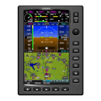
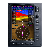
The Vertical Deviation (Glidepath) Indicator (VDI) also appears to the left of the altimeter during a GPS
approach. The glidepath is analogous to the glideslope for GPS approaches supporting WAAS vertical
guidance (LNAV+V, L/VNAV, LPV). The Glidepath Indicator appears on the G3X Touch as a magenta
diamond. The magenta 'G' indicates a GPS source. If the approach type downgrades past the final
approach fix (FAF), “NO GP” is annunciated.
An external navigation source is not required to receive VNAV indications. A magenta chevron (VNAV
Indicator) to the left of the altimeter on the Vertical Deviation Scale shows the VNAV profile, and a
magenta chevron (Required Vertical Speed Indicator (RVSI)) on the Vertical Speed Indicator indicates
the required vertical speed to reach the target altitude. The magenta 'V' indicates a VNAV profile is
active.
7.3 HSI Annunciations
Some or all HSI annunciations may appear in the four quadrants of the G3X Touch HSI depending on
the external navigator(s) configured.
Amber LOI – Loss of GPS integrity
Amber or Magenta VFR – An external GPS source is configured but there is not enough guidance
data for IFR use.
Amber REV – External navigation source failed. Reverted to internal VFR GPS for navigation.
Amber MSG – External navigation source has a pending message
Cyan INT – The pilot has elected to use the internal GPS navigation source instead of the external
GPS navigation source.
7.4 Course Deviation Indicator (CDI)
The HSI contains a Course Deviation Indicator (CDI), with a Course Pointer, To/From Indicator, and a
sliding deviation bar and scale. The course pointer is a single line arrow (GPS1, VOR1, and LOC1) or
a double line arrow (GPS2, VOR2, and LOC2) which points in the direction of the set course. The
To/From arrow rotates with the course pointer and is displayed when the active NAVAID is received.
The Course Deviation Indicator (CDI) moves left or right from the course pointer along a lateral
deviation scale to display aircraft position relative to the course. If the course deviation data is not
valid, the CDI is not displayed.
Another Lateral Deviation Scale and combination Course Deviation and To/From Indicator is located
below the slip/skid indicator.
 Loading...
