• Wrap When Full—causes the track log to
record over the oldest data with new data.
•
Record Method—Distance records track points
after a specied distance is traveled. Time creates
track points after a specied time has elapsed.
Auto allows you choose from ve intervals.
• Interval—records a track according to the
Record Method (Time, Distance, or Auto) and
Interval (Time, Distance, or Frequency). Enter
a specic distance, time, or frequency.
• Color
—selects the color of the active track.
•
Log Track to Data Card—records the current
track log to the microSD card in addition to the
unit’s internal memory. Using this option allows
you to record a large number of track points
(depending on the capacity of the microSD card.)
This feature is a tool for use by advanced GPS
users with special applications for track log data.
Track logs on the data card are .gpx GPS position
data les, and are not used by your unit. To learn
more about .gpx les, search the Web for subjects
titled GPX or
GPS Exchange Format.
To save the entire track log:
1. Press MENU twice to open the Main Menu.
2. Select the Tracks icon, and press ENTER to
open the Tracks Page.
3 Highlight the Save button and press ENTER.
A message appears asking you if you want to
save the entire track.
4. Select Yes, and press ENTER to save the
track. A “Saving Track” message appears
followed by the Saved Track Page.
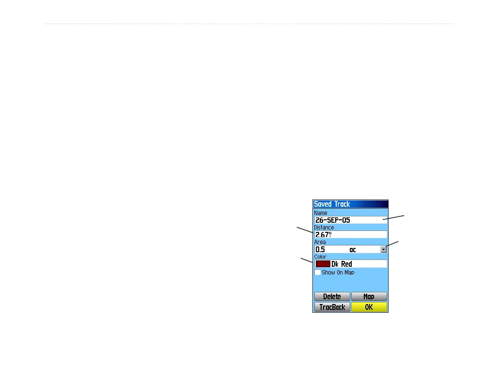
Use the Saved Track page to rename the track,
view the track distance and calculated area, and
specify a color for the track on the Map Page
.
Track
name
Track
distance
Track
color
Calculated
area
Saved Track Page
GPSMAP 60Cx Owner’s Manual 27
bAsIc oPerAtIon > usIng trAcKs
 Loading...