• To change the course name, select Name.
• To edit the course path, select Edit.
• To delete the course, select Delete.
Marking and Starting Navigation to a Man
Overboard Location
You can save a man overboard (MOB) location, and
automatically start navigation back to it.
TIP: You can customize the hold function of the keys to access
the MOB function (Customizing the Hot Keys, page 22).
1
From the watch face, press GPS.
2
Select an activity.
3
Hold MENU.
4
Select Navigation > Last MOB.
Navigation information appears.
Navigating with Sight 'N Go
You can point the device at an object in the distance, such as a
water tower, lock in the direction, and then navigate to the
object.
1
From the watch face, press GPS.
2
Select an activity.
3
Hold MENU.
4
Select Navigation > Sight 'N Go.
5
Point the top of the watch at an object, and press GPS.
Navigation information appears.
6
Press GPS to begin navigation.
Navigating to Your Starting Point During an
Activity
You can navigate back to the starting point of your current
activity in a straight line or along the path you traveled. This
feature is available only for activities that use GPS.
1
During an activity, select GPS > Back to Start.
2
Select an option:
• To navigate back to the starting point of your activity along
the path you traveled, select TracBack.
• To navigate back to the starting point of your activity in a
straight line, select Straight Line.
Your current location , the track to follow , and your
destination appear on the map.
Navigating to the Starting Point of a Saved
Activity
You can navigate back to the starting point of a saved activity in
a straight line or along the path you traveled. This feature is
available only for activities that use GPS.
1
From the watch face, press GPS.
2
Select an activity.
3
Hold MENU.
4
Select Navigation > Activities.
5
Select an activity.
6
Select Back to Start, and select an option:
• To navigate back to the starting point of your activity along
the path you traveled, select TracBack.
• To navigate back to the starting point of your activity in a
straight line, select Straight Line.
A line appears on the map from your current location to the
starting point of the last saved activity.
NOTE: You can start the timer to prevent the device from
timing out to watch mode.
7
Press DOWN to view the compass (optional).
The arrow points toward your starting point.
Stopping Navigation
1
During an activity, hold MENU.
2
Select Stop Navigation.
Calculating the Size of an Area
Before you can calculate the size of an area, you must acquire
satellites.
1
From the watch face, press GPS.
2
Select Area Calc..
3
Walk around the perimeter of the area.
TIP: You can hold MENU, and select Pan/Zoom to adjust the
map (Panning and Zooming the Map, page 11).
4
Press GPS to calculate the area.
5
Select an option:
• To exit without saving, select Done.
• To convert measurements of the area to a different unit of
measure, select Change Units.
• To save, select Save Activity.
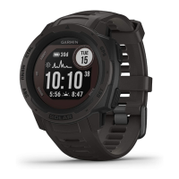
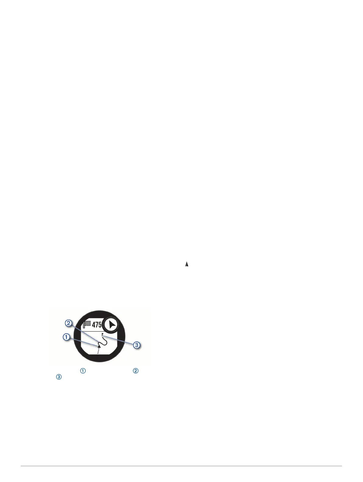
Map
represents your location on the map. Location names and
symbols appear on the map. When you are navigating to a
destination, your route is marked with a line on the map.
• Map navigation (Panning and Zooming the Map, page 11)
• Map settings (Map Settings, page 21)
Panning and Zooming the Map
1
While navigating, press UP or DOWN to view the map.
2
Hold MENU.
3
Select Pan/Zoom.
4
Select an option:
• To toggle between panning up and down, panning left and
right, or zooming, press GPS.
• To pan or zoom the map, press UP and DOWN.
• To quit, press BACK.
Compass
The device has a 3-axis compass with automatic calibration.
The compass features and appearance change depending on
your activity, whether GPS is enabled, and whether you are
navigating to a destination. You can change the compass
settings manually (Compass Settings, page 20). To open the
compass settings quickly, you can press GPS from the compass
widget.
Altimeter and Barometer
The device contains an internal altimeter and barometer. The
device collects elevation and pressure data continuously, even
in low-power mode. The altimeter displays your approximate
Navigation 11
 Loading...