Figure 5
Wiring method
Geophysical lines are generally arranged perpendicular to the line to be constructed , can
detect tectonic crushed zone on both sides of the border and its different physical
characteristics , contrast is strong, crushing width , extending distinctive characteristics.
In order to accurately locate, confirmed the location of the abnormal ground point, generally
use measuring rope ( or tape ) pull straight line, and mark with paint at the beginning of the
measuring line, so that find、measure position according to the test results of drawing later.
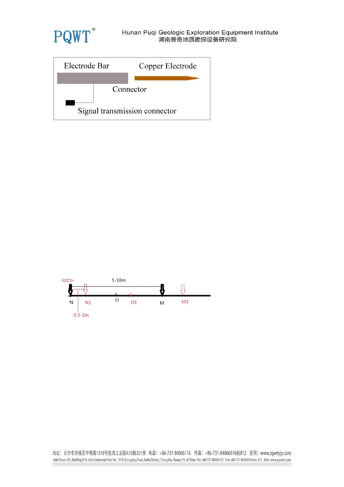
The collected data each time is the data of midpoint between two electrode data, the point O
is the first set of data as shown below in figure 6. Electrode spacing is generally 5-10m
( Choose 6/8/10m according to your actual situation), dot spacing is generally about 0.5-2m,
electrode spacing and dot spacing must keep the same distance for one measuring line.
M, N is electrode , O is the first measurement point, O1 is the second measurement point. NM =
5-10M, measuring point spacing is generally 0.5-2m.
Figure 6
Data Transmission and Data Format
In the field, after data collection needs a complete chart analysis or the data is full inside the
instrument, we need to transfer out the data. The data of instrument can be transferred directly to
the U disk , plug U disk into the the instrument 's USB interface.
The instrument can transmit three frequency measurement data and multi-frequency measurement
data, line as a unit, first select the required transmission line number, then select all data for this
line . Specific operations are as follows.
 Loading...