4-10
RayChart 420/420D Chartplotter
4.4 GPS setup
The GPS set up page provides information for the status of the tracked
navigation satellites plus HDOP and satellite Fix Status. It also provides the
ability to set up a Differential GPS (RC420D), by manually retuning it to a
different differential beacon.
ä
To select GPS Set Up:
1. Press the PAGE key to display the SET UP functions:
2. Use the trackpad to highlight the GPS SET UP function and press ENTER
to display the GPS SET UP menu.
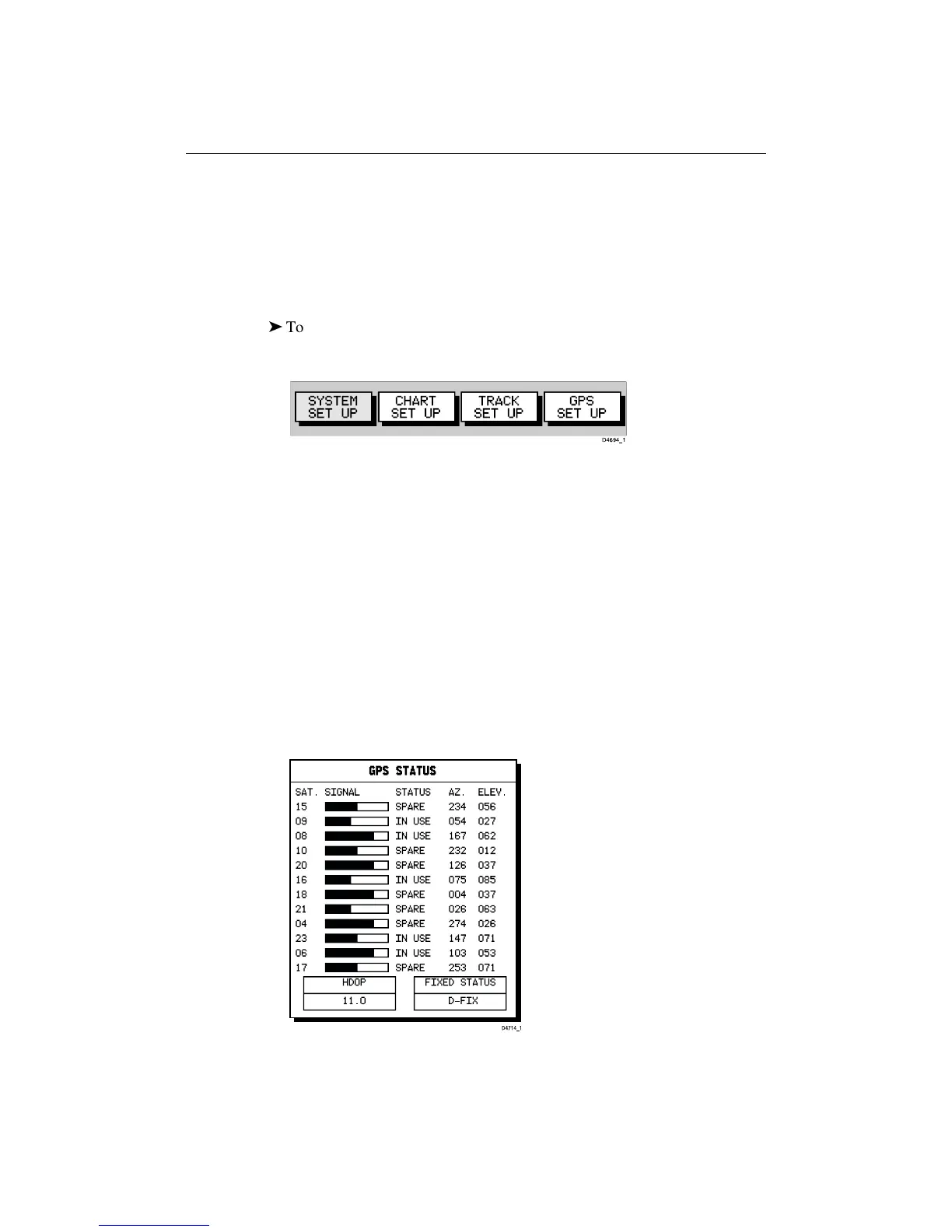
The GPS Status window is displayed as shown below. This provides, for each
tracked satellite, the satellite number, a graphical signal strength bar, status,
azimuth angle and its elevation angle from your vessel.
Positional accuracy is dependent upon these parameters; in particular, the
azimuth and elevation angles are used in a triangulation process to calculate
your position. HDOP (Horizontal Dilution Of Position) is a measure of this
accuracy; a higher figure signifies greater error. In ideal circumstances, the
figure should be in the region of 1.0. The Fix Status can indicate:
• NO FIX, where no satellite fix can be acquired
• FIX OK, where a satellite fix has been acquired
• D-FIX, where a differential beacon fix has been acquired
 Loading...