19
SECTION
1
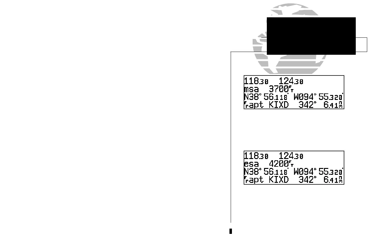
Position page displaying MSA. MSA and ESA are
based on data stored in the NavData card. This
information cannot be solely relied upon as an
absolute measure of safe altitude in your area.
Consult current charts and NOTAMs.
NAV KEY
Position Page &
Reference Waypoints
The same position page displaying ESA.
The altitude field can display either the present altitude, minimum safe altitude
(MSA) or en route safe altitude (ESA). MSA is the recommended minimum altitude
within a ten mile radius of your present position. ESA is the recommended minimum
altitude within a ten mile radius of your course on an active route or direct-to. MSA
and ESA altitudes are calculated from information contained in the database and gen-
erally include mountains, buildings and other permanent features (see right).
To change the altitude field:
1. Press
C
twice to obtain a cursor in the GPS window.
2. Rotate
O
until the ‘alt/ESA/MSA’ field is highlighted.
3. Rotate
K
to display the desired data. Press
C
to return to normal navigation.
The position page also features a reference waypoint field, located at the bottom
of the page, to indicate your bearing and distance from a selected waypoint. The ref-
erence waypoint field can display the following:
• Range, bearing and identifier from the nearest airport (default), VOR,
NDB, intersection, or user waypoint
• Range, bearing, and identifier from a user specified waypoint
The default setting is to display the nearest airport. During DME arc approach opera-
tions, the reference field will automatically display the DME reference as long as the ‘active
to’ waypoint is part of the DME arc.
To change the reference waypoint field to display the nearest airport, VOR, NDB,
intersection, user waypoint or the range and bearing from a user selected waypoint:
1. Press
C
twice to activate the cursor in the GPS window.
2. Rotate
O
to highlight the category field after the
f
r.
300xl manual 1/25/99 2:35 PM Page 19
 Loading...