BASIC FUNCTIONS
16
INFORMATION
When the map scale is at the maximum
range of 250 miles (400 km), is not
shown. When the map scale is at the
minimum range of 150 feet (50 m),
is not shown. However, in the area
where the foot print map is contained,
when the map scale is changed to 150
feet (50 m), changes to .
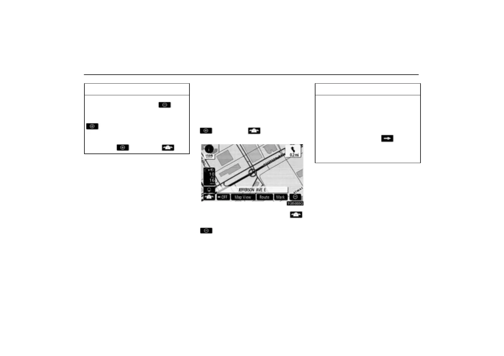
— Foot print map
For the area which is covered by the foot print
map (Some areas in the following cities; De-
troit, Chicago, N.Y., L.A), you can switch to
the foot print map on a scale of 75 feet (25 m).
To switch to the foot print map
changes into when the map is
scaled down to 150 feet (50 m).
To display the foot print map, touch .
To delete the foot print map display, touch
.
INFORMATION
If the map or the current position is
moved to the area which is not cov-
ered by the foot print map, the screen
scale automatically changes to 150
feet (50 m).
On the foot print map, a one way
street is displayed by .
It is not possible to perform scrolling
on the foot print map (one-touch
scroll) while driving.
 Loading...