Infotainment System 33
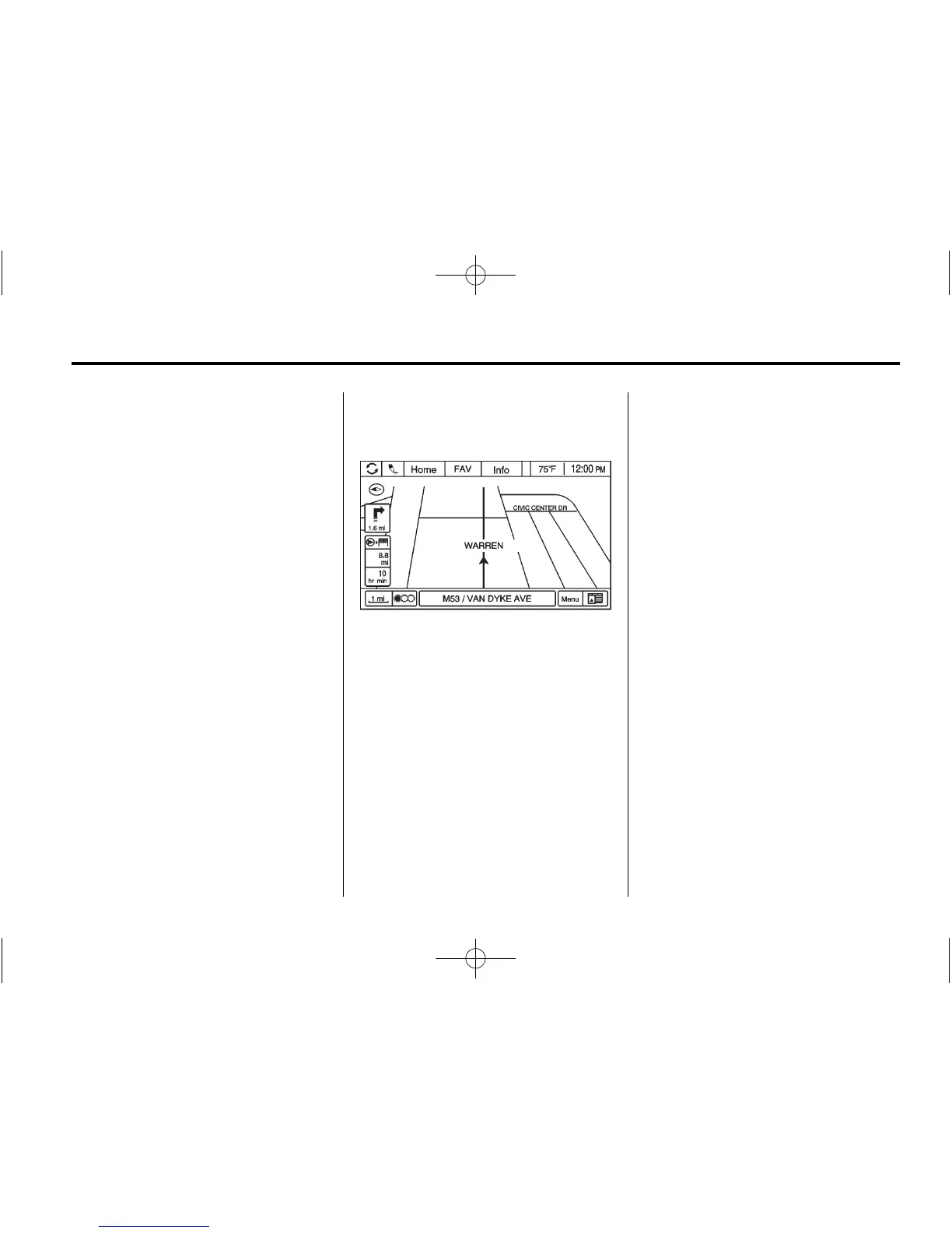
Current Position Information
Press to display a split screen
showing detailed information about
the vehicle position. This feature
can also be accessed by pressing
the vehicle information tab located
on the lower center of the display.
Destination Information
Press to display a split map
screen showing the next
waypoint/destination.
Map Adjustments
The system lets you adjust the scale
of view on the map. Also, as you
drive, the map scrolls automatically
based on the direction of travel.
Map Scales
There are two methods to change
the map scale:
.
Turn the MENU/SEL knob
clockwise or counterclockwise
to zoom out or in.
.
Press the Map Scale button on
the left bottom corner of the
map screen to change the
zoom level.
The map scale bar times out if
the zoom level is not changed
within a few seconds.
The scale ranges from 50 m (50 yd)
to 350 km (250 mi). To change from
metric to English, see “Driver
Information Center (DIC)” in the
Index of the owner manual for more
information.
 Loading...