5-2
2. Press the WAYPOINTS soft key to display
the WPT menu.
WPT
GPS 3D
LOCAL LIST
WAYPOINT BY CURSOR
ALPHA/NUMERIC LIST
WAYPOINT BY RANGE & BEARING
RETURN
ADD/EDIT/MOVE WAYPOINTS
Waypoint menu
3. Press the WAYPOINT BY CURSOR soft
key. The plotter display appears.
4. Operate the cursor pad to place the cursor
on the location desired.
5. Press the NEW WPT soft key. The new
waypoint window appears and it shows
mark shape, waypoint name, comment
(default: date), position of waypoint and
proximity alarm radius.
GPS 3D
NEW
WPT
MARK
COMMENT
NAME
RETURN
LAT
LON
PROXIMITY
ALARM RADIUS
0 0 1 WPT
17:38 24MAY02
34 12. 345' N
135 12. 3457' W
0.00 nm
SELECT
MARK
COORD
TYPE
N<-->S
E<-->W
SAVE
Waypoint window
6. If you do not need to change the waypoint
data, simply press the SAVE soft key to
register the waypoint and return to the
plotter display. Be sure to press the SAVE
soft key only after changing all
data. Refer
to the following procedures to change the
waypoint data.
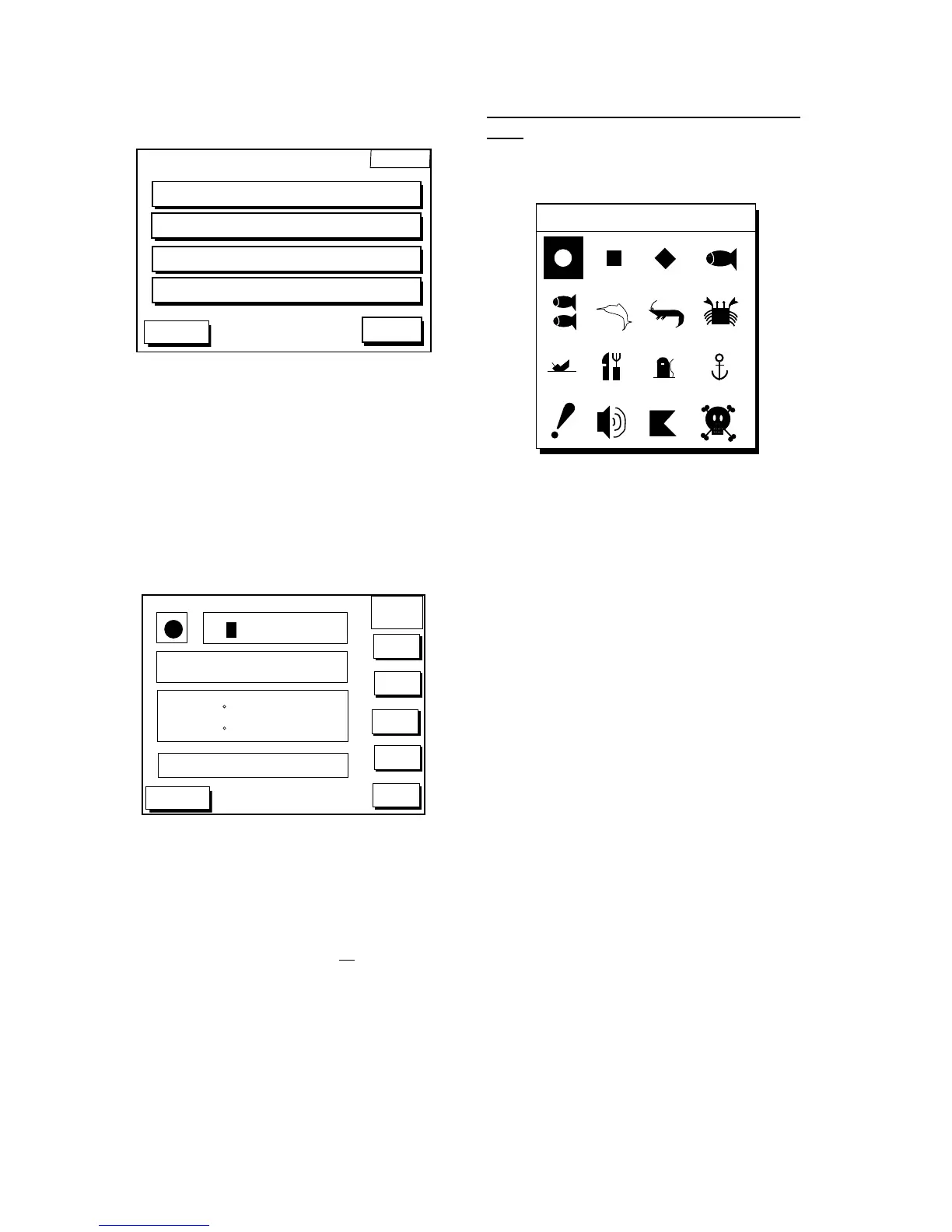
Changing the shape and color of waypoint
mark
1. Press the SELECT MARK soft key to open
the SELECT MARK window.
SELECT MARK
Select mark window
3. Operate the cursor pad to select shape
desired.
4. Press the ENTER soft key or the [ENTER]
key.
 Loading...