SP - 1 E4423S01A
SPECIFICATIONS OF GPS PLOTTER
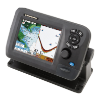
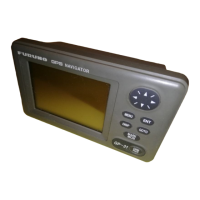
GP-1640
1 GENERAL
1.1 Display 5.7-inch monochrome LCD
1.2 Projection Mercator
1.3 Usable Area 85° latitude or below
1.4 Display Mode Plotter, Video pilot, Highway display, Waypoint display
1.5 Alarms Arrival and Anchor watch, Cross track error and proximity alarms,
Ship’s speed in and out alarms
2 GPS RECEIVER
2.1 Receiving Channels
GPS 12 channels parallel, 12 satellites tracking
WAAS 1 channel
2.2 Rx Frequency 1575.42 MHz
2.3 Rx Code C/A code, WAAS
2.4 Position Fixing System All in view, 8-state Kalman filter
2.5 Position Accuracy
GPS 10 m (95% of the time, HDOP 4)
DGPS 5 m (95% of the time, external data required)
WAAS 3 m (95% of the time)
2.6 Tracking Velocity 999 kt
2.7 Position-fixing Time Warm start: 12 s approx., Cold start: 90 s approx.
2.8 Position Update Interval 1 s
3 DISPLAY UNIT
3.1 Display Mode monochrome, 5 levels (include base color)
3.2 Effective Area 115 (W) x 84.2 (H) mm
3.3 Display Pixels 320 (W) x 240 (H) dots
4 PLOTTER FUNCTIONS
4.1 Effective Projection Area 0.125 nm to 2,048 nm (at equatorial area)
4.2 Track Display Plot interval: by time (1 s to 99 m 59 s)
or by distance (0.01 nm to 99.99 nm)
4.3 Memory Capacity Track/Mark: 5000 points, waypoint: 800 point
4.4 Storage Capacity Simple route: 200 routes with 35 waypoints each
4.5 MOB 1 point
 Loading...