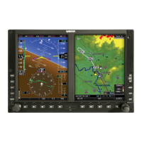
AFMS, GARMIN G500 PFD/MFD SYSTEM 190-01102-01 Rev. 9
FAA APPROVED Page 15 of 40
1.13 Definitions
The following terminology is used within this document:
ADC: Air Data Computer
ADF: Automatic Direction Finder
AHRS: Attitude & Heading Reference System
AUX: Auxiliary
BARO: Barometric Pressure
BRG: Bearing
CDI: Course Deviation Indicator
CRS: Course
FD: Flight Director
FPM: Flight Path Marker
GDU: Garmin Display Unit
GPS: Global Positioning System
GPSS: GPS Roll Steering
HDG: Heading
HSI: Horizontal Situation Indicator
IFR: Instrument Flight Rules
IMC: Instrument Meteorological Conditions
LOI: Loss of Integrity
MFD: Multi Function Display
PFD: Primary Flight Display
SBAS: Space-based Augmentation System
SD: Secure Digital
SVT: Synthetic Vision Technology
TAS: Traffic Awareness System
TAWS: Terrain Awareness and Warning System (a TSO-C151b
function)
TCAS: Traffic Collision and Avoidance System
TIS: Traffic Information Service
VFR: Visual Flight Rules
VMC: Visual Meteorological Conditions
V/S: Vertical Speed

 Loading...


