3
Select an option:
• Drag the map to pan left, right, up, or down.
• To zoom in or out, select or .
• To switch between North Up and 3-D views, select .
• To filter the displayed points of interest by category, select
.
• To start a route, select a location on the map, and select
Go! (Starting a Route by Using the Map).
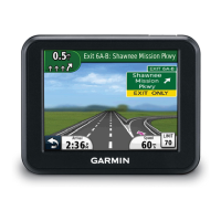
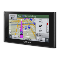
Map Tools
Map tools provide quick access to information and device
functions while you are viewing the map. For example, you can
view traffic information, take a detour, or adjust the screen
brightness without leaving the map. When you activate a map
tool, it appears in a panel at the edge of the map.
Viewing a Map Tool
1
From the map, select .
2
Select a map tool.
The map tool appears in a panel at the edge of the map.
3
When you are done using the map tool, select .
Enabling Map Tools
By default, only the most commonly used map tools are enabled
in the map tools menu. You can enable additional tools.
1
From the map, select > .
2
Select the check box next to each tool to add.
3
Select Save.
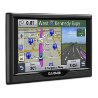
Up Ahead
You can view upcoming businesses and services along your
route or the road on which you are traveling. Services are
filtered by category.
Finding Upcoming Points of Interest
1
From the map, select > Up Ahead.
2
Select a category.
3
Select a point of interest on the map.
Customizing the Up Ahead Categories
You can change the categories you search for, rearrange the
order of the categories, and search for a specific business or
category.
1
From the map, select > Up Ahead.
2
Select a service icon.
3
Select .
4
Select an option:
• To move a category up or down in the list, select and drag
the arrow next to the category name.
• To change a category, select the category.
• To create a custom category, select a category, select
Custom Search, and enter the name of a business or
category.
5
Select Done.
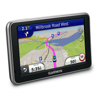
Trip Information
Viewing Trip Data from the Map
Before you can view trip data on the map, you must add the tool
to the map tools menu (Enabling Map Tools).
From the map, select > Trip Data.
Customizing the Trip Data Fields
Before you can customize the data that appears in the trip data
fields on the map, you must add the Trip Data tool to the map
tools menu (Enabling Map Tools).
1
Select View Map.
2
Select > Trip Data.
3
Select a trip data field.
4
Select an option.
The new trip data field appears in the trip data list.
Viewing the Trip Information Page
The trip information page displays your speed and provides
statistics about your trip.
NOTE: If you make frequent stops, leave the device turned on,
so it can accurately measure elapsed time during the trip.
From the map, select Speed.
Viewing the Trip Log
Your device keeps a trip log, which is a record of the path you
have traveled.
1
Select Settings > Map & Vehicle > Map Layers.
2
Select the Trip Log check box.
Resetting Trip Information
1
From the map, select Speed.
2
Select > Reset Field(s).
3
Select an option:
• When not navigating a route, select Select All to reset
every data field except the speedometer, on the first page.
• Select Reset Trip Data to reset the information on the trip
computer.
• Select Reset Max. Speed to reset the maximum speed.
• Select Reset Trip B to reset the odometer.
Viewing Upcoming Traffic
You can view traffic incidents coming up along your route or
along the road on which you are traveling.
1
While navigating a route, select > Traffic.
The nearest upcoming traffic incident appears in a panel on
the right side of the map.
2
Select the traffic incident to view additional details.
Viewing Traffic on the Map
The traffic map shows color-coded traffic flow and delays on
nearby roads.
1
From the main menu, select Apps > Traffic.
2
If necessary, select > Legend to view the legend for the
traffic map.
Searching for Traffic Incidents
1
From the main menu, select Apps > Traffic.
2
Select > Incidents.
3
Select an item in the list.
4
If there is more than one incident, use the arrows to view
additional incidents.
Safety Cameras
NOTICE
Garmin is not responsible for the accuracy of or the
consequences of using a custom point of interest or a safety
camera database.
NOTE: This feature is not available for all regions or product
models.
10 Using the Map
 Loading...