EasyManuals Logo

Garmin Streetpilot C320 User Manual

Garmin Streetpilot C320
37 pages
To Next Page IconTo Next Page
To Previous Page IconTo Previous Page
Page #12 background imageLoading...
Page #12 background image
Garmin © 2005 8 c320 Owner’s Manual
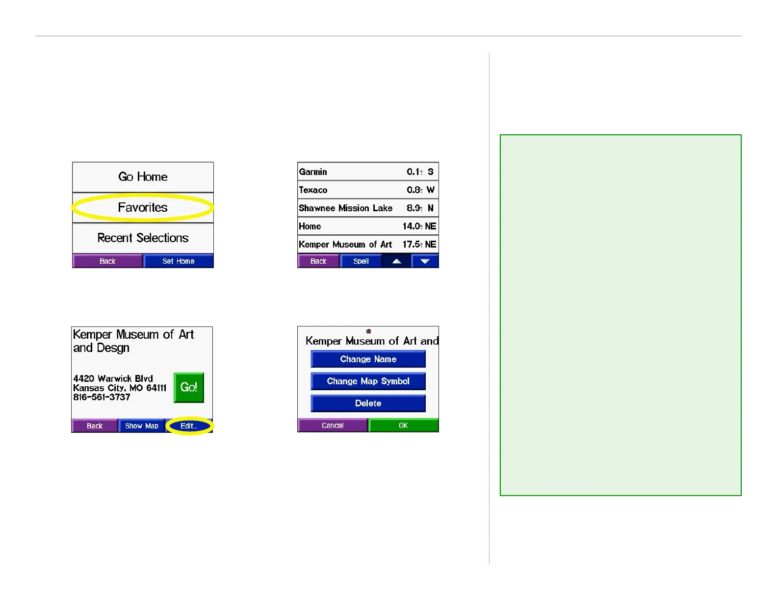
MY LOCATIONS
Editing Saved Places
After you save a place, you can change the name of the place and
its symbol on the map. From the Menu page, touch Where to? >
My Locations.
Touch Favorites.
Select the place
you want to edit.
Touch the Edit button.
The Edit window opens.
Touch a button to
change the name or
the map symbol, or
to delete the item.
Changing the Name
To change the name of the saved
place, touch Change Name.
Enter the new name using the
on-screen keyboard that appears.
Touch Done.
Changing the Map
Symbol
To change the symbol of this place
used on the map, touch Change
Map Symbol. Select a symbol
from the list that appears.
Deleting Saved Places
To delete this saved place, touch
Delete. Then touch Yes.

Other manuals for Garmin Streetpilot C320

Questions and Answers:

Question and Answer IconNeed help?

Do you have a question about the Garmin Streetpilot C320 and is the answer not in the manual?

Garmin Streetpilot C320 Specifications

General IconGeneral
AutoYes
Marine (chartplotters, sounders)No
Routes quantity0
Number of waypoints500
Form factorPlug-in
Product colorBlack
Display resolution320 x 240 pixels
Internal memory type-
Battery life (max)8 h
Weight and Dimensions IconWeight and Dimensions
Depth72 mm
Width113 mm
Height82 mm
Weight269 g

Related product manuals