EasyManua.ls Logo

LG 550 Series User Manual

LG 550 Series
76 pages
To Next Page IconTo Next Page
To Previous Page IconTo Previous Page
Page #43 background imageLoading...
Page #43 background image
43
Search for a location
The search will be carried out around a certain
reference point. Always look at the current reference
point shown in the blue field above the POI category
buttons and confirm that it matches what you want.
To change the reference, tap the “Change ref.” button
in the top right corner.
Once you tap the “Change ref.” button, you are
presented with these choices.
Address :
You can specify an address to be searched, or a
settlement to search in. The centre of this settlement
will be used as the reference point.
History :
The reference for the search can be selected from the
History list.
Coodinates :
You can specify a latitude/longitude pair to be the
centre of the search.
Current GPS :
The search will be carried out around the current
location given by the GPS if it is available. If no GPS
position is available, the last known GPS position will
be used.
Cursor :
The search will be carried out arround the previously
selected map point.
Destination :
The search will be carried out arround the destination
of your current route.
Once you have set the reference point, you have the
following potions on the “Find POI” screen.

Table of Contents

Question and Answer IconNeed help?

Do you have a question about the LG 550 Series and is the answer not in the manual?

LG 550 Series Specifications

General IconGeneral
BrandLG
Model550 Series
CategoryGPS
LanguageEnglish

Summary

Safety note

Connecting devices

Installation sequence for the suction-cup mount

Step-by-step guide for securely attaching the navigation device mount to a windshield.

Installing Microsoft ActiveSync

Steps to install the software required for synchronizing data between PC and the navigation device.

Connecting the USB cable

Instructions for connecting the device to a PC using a USB cable for data transfer.

Before operation

Starting up

Guide on powering on the device and initial startup procedures.

Screen with Map

Map screen

Detailed explanation of the map display interface, including navigation information and controls.

Cursor menu

Explains the context menu that appears when the cursor is selected on the map.

Search for a location

Route Manager

Options for managing and modifying route settings and parameters.

Setup

Access to various settings to customize the navigator's functions.

Find an Address, Street, Intersection or City

Module for searching locations by address, street, intersection, or city name.

Selecting the city, state and country to search in

How to choose the geographical area for a location search.

Selecting a new settlement to search in

Method for inputting city or postcode when a settlement isn't listed.

Selecting a street or the centre of the settlement

Specifying a street name or the center of a settlement for navigation.

Selecting a street

How to search for specific streets within a chosen settlement.

Selecting a house number or the midpoint of the street

Entering a house number or using the street midpoint for precise location selection.

Find Coordinates

Entering destination using latitude and longitude coordinates.

Find a POI

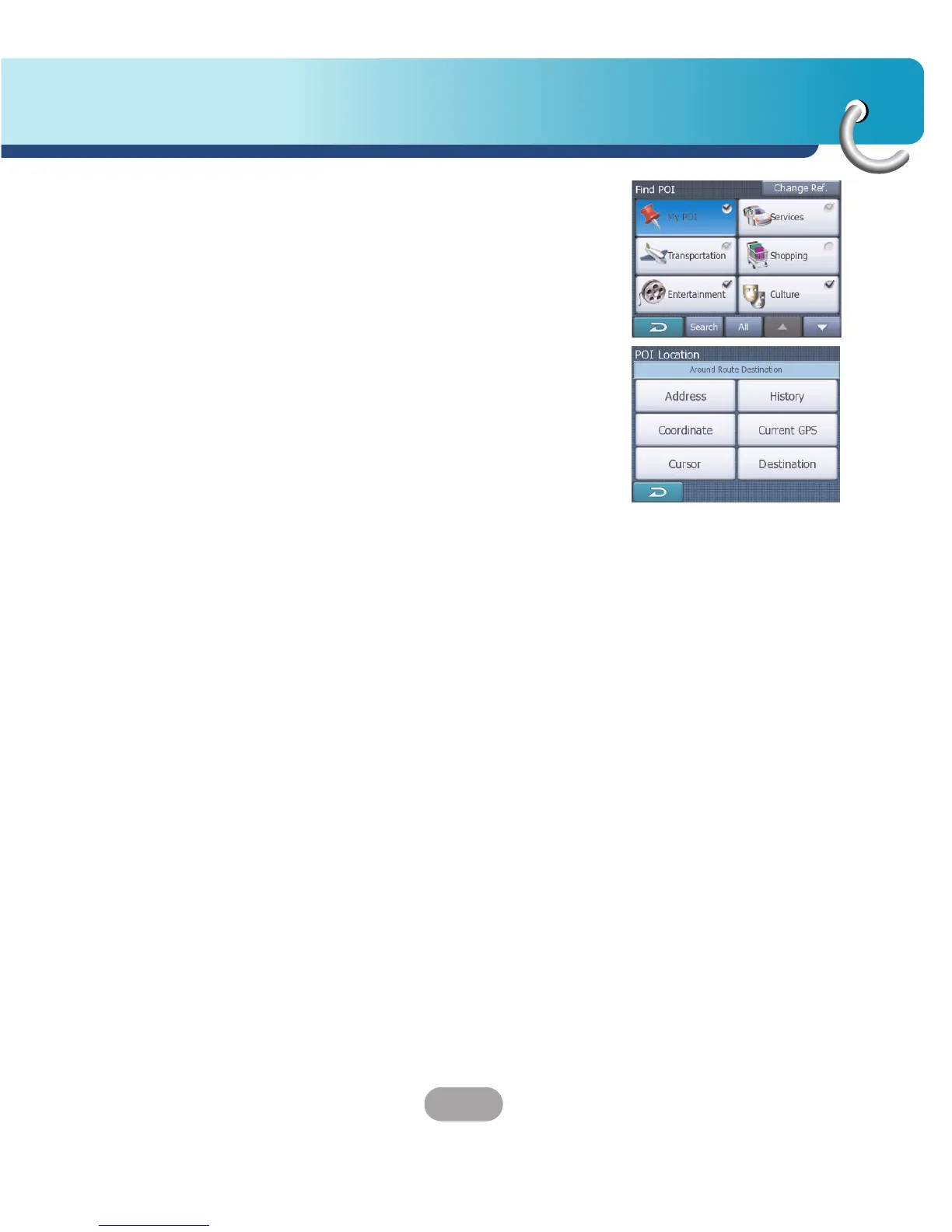
Searching for Points of Interest (POIs) categorized for easy location.

Route manager

TBT Summary

Displays a summary of the route's itinerary, turn-by-turn instructions, and route overview.

Manage POI (Points of Interest)

Setting visibility and parameters for built-in and user-created Points of Interest.

Edit Way Point

Modifying the sequence and details of points within a planned route.

Setup

Route parameter

Defining route calculation preferences, vehicle type, and road type exclusions.

Troubleshooting

Cannot identify the current location. (GPS not receiving)

Troubleshooting steps for issues related to the GPS receiver failing to acquire a location signal.