NX702 English 99
6 Glossary
2D/3D GPS reception
The GPS receiver uses satellite signals to calculate its (your) position and needs at least four signals to
give a three-dimensional position, including elevation. Because the satellites are moving and because
objects can block the signals, your GPS device might not receive four signals. If three satellites are
available, the receiver can calculate the horizontal GPS position but the accuracy is lower and the GPS
device does not give you elevation data: only 2D reception is possible.
Active route
The currently navigated route. Whenever the destination is set, the route is active until you delete it, reach
your destination or you quit Clarion Mobile Map. See also: Route.
City Center
The city/town center is not the geometric center of the city/town but an arbitrary point the map creators
have chosen. In towns and villages, it is usually the most important intersection; in larger cities, it is one of
the important intersections.
Color theme
Clarion Mobile Map comes with different color themes for daytime or night use of the map and menu
screens. Themes are custom graphic settings and they can have different colors for streets, blocks or
surface waters in 2D and 3D modes, and they display shades or shadows in different ways in 3D mode.
One daytime scheme and one night scheme is always selected for the map and for the menus. Clarion
Mobile Map uses them when it switches from day to night and back.
GPS accuracy
Several factors have impact on the deviation between your real position and the one given by the GPS
device. For example, signal delay in the ionosphere or reflecting objects near the GPS device have a
different and varying impact on how accurately the GPS device can calculate your position.
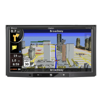
Map
Clarion Mobile Map works with digital maps which are not simply the computerized versions of traditional
paper maps. Similarly to the paper road maps, the 2D mode of digital maps show you streets, roads, and
elevation is also shown by colors.
In 3D mode, you can see the altitude differences, for example valleys and mountains, elevated roads, and
in selected cities 3D landmarks and 3D buildings are also displayed.
 Loading...