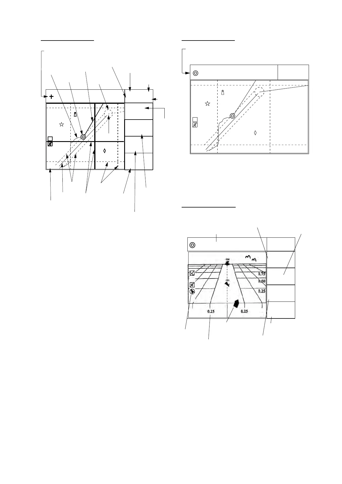
1. OPERATION
1-4
Plotter 1 display
44.0˚
D3D 100m
* SAFE
34° 23.456´ N 135° 45.678´ E
BRG
32.0˚
BRG TO +
11.5
RNG TO +
NM
123.0
°
COG
[01]
30
40
20
50
H
2.00 NM
Cursor position data,
when cursor is on
Own ship's
track
Own ship
mark
Course bar
Bearing
from
own ship
to desti-
nation
waypoint
GPS receiving
condition
Alarm
range
Bearing from own
ship to cursor
Course over ground
Grid
Cursor
Range
from own ship
to cursor
Course
width
Course
Datum
(True Motion),
Horizontal range
TM W84
Distance for
RAIM reliability
Blinking asterisk (*)
indicates data is
being refreshed.
*: For RAIM function, refer to page 8-1.
Waypoint
RAIM
reliability*
Figure 1-5 Plotter 1 display
Plotter 2 display
[01]
30
40
20
50
H
2.84 NM
Ship's position appears when cursor is off
D3D 100m
* SAFE
34° 23.456´ N 135° 45.678´ E
TM W84
Figure 1-6 Plotter 2 display
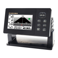
Highway display
34.0˚
D3D 100m
* SAFE
34˚ 23.456´ N 135˚ 45.678´ E
BRG
45.0˚
RNG
12.3
SOG
kn
0.35NM
COG
Course over ground
Bearing from own ship to
destination waypoint
Position
Speed over ground
Range from own ship to
destination waypoint
Own ship mark
Cross track error scale
North mark
W84
NM
Figure 1-7 Highway display

 Loading...