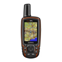
Satellite: Displays your current GPS satellite information
(Satellite Page, page 11).
BirdsEye Imagery
BirdsEye imagery provides downloadable, high-resolution map
imagery, including detailed satellite imagery and raster-based
topographical maps. You can download BirdsEye imagery
directly to your compatible Garmin device.
Downloading BirdsEye Imagery
Before you can download BirdsEye imagery directly to your
device, you must connect to a wireless network (Connecting to a
Wireless Network, page 7).
1
Select BirdsEye Direct > Download Imagery.
2
Select an option:
• To download BirdsEye imagery files for a specific location
or area, select Location, and select a category.
NOTE: The location defaults to your current location.
• To edit the name of the downloaded imagery files, select
Name.
• To select an image quality option, select Detail.
• To define the size of the area to be shown in the
downloaded imagery files, select Radius, and enter a
distance from the selected location.
An estimated file size appears for the selected image quality
and radius. You should verify your device has enough
available storage space for the imagery file.
3
Select Download.
Geocaches
Geocaching is a treasure hunting activity in which players hide
or search for hidden caches using clues and GPS coordinates.
Registering Your Device at Geocaching.com
You can register your device at www.geocaching.com to search
for a list of nearby geocaches, or to search live information for
millions of geocaches.
1
Connect to a wireless network (Connecting to a Wireless
Network, page 7) or to the Garmin Connect Mobile app
(Pairing a Smartphone with Your Device, page 7).
2
Select Setup > Geocaching > Register Device.
An activation code appears.
3
Follow the on-screen instructions.
4
Select Confirm Registration.
Connecting to Geocaching.com
After you register, you can view geocaches from
www.geocaching.com on your device while connected
wirelessly.
• Connect to the Garmin Connect Mobile app.
• Connect to a Wi‑Fi network.
Downloading Geocaches Using a Computer
You can load geocaches manually onto your device using a
computer (Transferring Files to Your Device, page 15). You
can place the geocache files into a GPX file and import them
into the GPX folder on the device. With a premium membership
to geocaching.com, you can use the "pocket query" feature to
load a large group of geocaches onto your device as a single
GPX file.
1
Connect the device to your computer using a USB cable.
2
Go to www.geocaching.com.
3
If necessary, create an account.
4
Sign in.
5
Follow the instructions at geocaching.com to find and
download geocaches to your device.
Searching for a Geocache
You can search the geocaches loaded on your device. If you are
connected to geocaching.com, you can search live geocache
data and download geocaches.
NOTE: You can download detailed information for a limited
number of geocaches per day. You can purchase a premium
subscription to download more. Go to www.geocaching.com for
more information.
1
Select Geocaching.
2
Select > MENU.
3
Select an option:
• To search the geocaches loaded on your device by name,
select Spell Search, and enter a search term.
• To search for geocaches near you or near another
location, select Search Near, and select a location.
If you are connected to geocaching.com, the search
results include live geocache data obtained by GC Live
Download.
• To search for live geocaches by code, select GC Live
Download.
This feature allows you to download a specific geocache
from geocaching.com when you know the geocache code.
4
Select MENU > Filter to filter the search results (optional).
5
Select > Download Geocaches to search for and
download nearby geocaches on the map (optional).
6
Select a geocache.
The geocache details appear. If you selected a live geocache
and you are connected, the device downloads the full
geocache details to the internal storage, if necessary.
Filtering the Geocache List
You can filter your geocache list based on certain factors, such
as the level of difficulty.
1
Select Geocaching > MENU > Filter.
2
Select one or more options to filter:
• To filter by a geocache category, such as puzzle or event,
select Type.
• To filter by the physical size of the geocache container,
select Cache Size.
• To filter by Unattempted, Did Not Find, or Found
geocaches, select Status.
• To filter by the difficulty level of finding the geocache, or
the difficulty of the terrain, select a level from 1 to 5.
3
Select QUIT to view the filtered geocache list.
Saving a Custom Geocache Filter
You can create and save custom filters for geocaches based on
specific factors.
1
Select Setup > Geocaching > Filter Setup > Create Filter.
2
Select items to filter.
3
Select QUIT.
By default, the new filter is saved automatically as Filter
followed by a number. For example, Filter 2. You can edit the
geocache filter to change the name (Editing a Custom
Geocache Filter, page 9).
Editing a Custom Geocache Filter
1
Select Setup > Geocaching > Filter Setup.
2
Select a filter.
3
Select an item to edit.
Main Menu Tools 9
 Loading...
