Changing the Units of Measure
You can customize units of measure for distance and speed,
elevation, depth, temperature, pressure, and vertical speed.
1
Select Setup > Units.
2
Select a measurement type.
3
Select a unit of measure.
Time Settings
Select Setup > Time.
Time Format: Sets the device to show time in a 12-hour or 24-
hour format.
Time Zone: Sets the time zone for the device. Automatic sets
the time zone automatically based on your GPS position.
Profiles
Profiles are a collection of settings that optimize your device
based on how you are using it. For example, the settings and
views are different when you use the device for hunting than
when geocaching.
When you are using a profile and you change settings, such as
data fields or units of measurement, the changes are saved
automatically as part of the profile.
Creating a Custom Profile
You can customize your settings and data fields for a particular
activity or trip.
1
Select Setup > Profiles > Create Profile > OK.
2
Customize your settings and data fields.
Editing a Profile Name
1
Select Setup > Profiles.
2
Select a profile.
3
Select Edit Name.
4
Enter the new name.
Deleting a Profile
NOTE: Before you can delete the active profile, you must
activate a different profile. You cannot delete a profile while it is
active.
1
Select Setup > Profiles.
2
Select a profile.
3
Select Delete.
Resetting Data and Settings
1
Select Setup > Reset.
2
Select an option:
• To reset data specific to a trip, such as distance and
averages, select Reset Trip Data.
• To delete all saved waypoints, select Delete All
Waypoints.
• To clear the data recorded since you started your current
activity, select Clear Current Activity.
NOTE: The device continues to record new data for the
current activity.
• To reset only the settings for your current activity profile to
the factory default values, select Reset Profile Settings.
• To reset all device settings and profiles to the factory
default values, select Reset All Settings.
NOTE: Resetting all settings clears all geocaching activity
from your device. It does not remove your saved user
data, such as tracks and waypoints.
• To remove all saved user data and reset all settings on
the device to the factory default values, select Delete All.
NOTE: Deleting all settings removes your personal data,
history, and saved user data, including tracks and
waypoints.
Restoring Default Page Settings
1
Open a page for which you will restore the settings.
2
Select MENU > Restore Defaults.
Device Information
Product Updates
On your computer, install Garmin Express
™
(www.garmin.com
/express). On your smartphone, you can install the Garmin
Explore app to upload your waypoints, routes, tracks, and
activities.
Garmin Express provides easy access to these services for
Garmin devices:
• Software updates
• Map updates
• Product registration
Setting Up Garmin Express
1
Connect the device to your computer using a USB cable.
2
Go to garmin.com/express.
3
Follow the on-screen instructions.
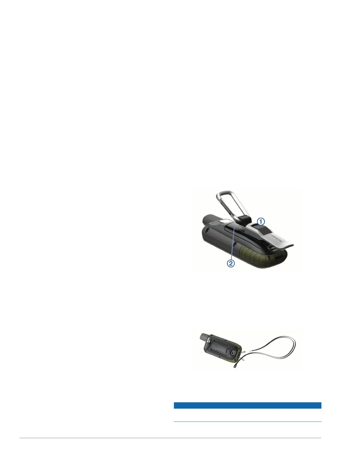
Attaching the Carabiner Clip
1
Position the carabiner clip
À
in the slots on the mounting
spine
Á
of the device.
2
Slide the carabiner clip up until it locks in place.
Removing the Carabiner Clip
Lift up on the bottom of the carabiner clip, and slide the
carabiner clip off the mounting spine.
Attaching the Wrist Strap
1
Insert the loop of the wrist strap through the slot in the
device.
2
Thread the other end of the strap through the loop, and pull it
tight.
Device Care
NOTICE
Avoid chemical cleaners, solvents, and insect repellents that can
damage plastic components and finishes.
14 Device Information

 Loading...