2 Description of the System
2.1 System Components
Component Description
Instrument To calculate a position from the computed ranges to all
visible G
NSS (Global Navigation Satellite System) satel-
lites.
To estimate a tilt compensated pole tip position by com-
bining the GNSS position with attitude information from
an Inertial Measurement Unit (IMU).
Antenna To receive the satellite signals from the GNSS satellites.
Instrument Description
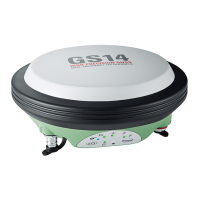
iCON gps 70 GPS, GLONASS, BeiDou and Galileo GNSS receiver, multi-
f
requency, code and phase, real-time capable, integrated
Inertial Measurement Unit.
2.2 System Concept
2.2.1 Software Concept
All instruments use the same software concept.
Software type Description
iCON gps 70
f
irmware
(iCG_xx.fw)
This software covers all functions of the instrument.
The English language is integrated into the firmware and
cannot be deleted.
☞
Uploading iCON gps 70 firmware can take some time. Ensure that the
ba
ttery is at least 75% full before beginning the upload, and do not
remove the battery during the upload process.
Software for Description
All iCON gps 70
mo
dels
☞
Ensure that a Leica SD card is inserted into the
iCON gps 70 instrument before starting the
upload. Refer to " Equipment setup".
2.2.2 Power Concept
Use the batteries, chargers and accessories recommended by Leica Geosystems
t
o ensure the correct functionality of the instrument.
Power for the instrument can be supplied either internally or externally.
Model Power supply
Internally One battery (GEB331) fits into the instrument.
Externally GEB371 battery connected via a cable, or
Car battery connected via a converter cable supplied by Leica
G
eosystems, or
Main components
Instrument
Description
Software for all
iCON gps 70 ins
tru-
ments
Software upload
General
Power options
18 Description of the System
 Loading...