EasyManuals Logo

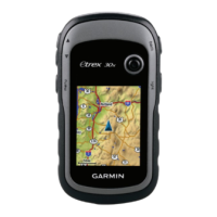
Garmin eTrex 30 User Manual

Garmin eTrex 30
60 pages
To Next Page IconTo Next Page
To Previous Page IconTo Previous Page
Page #10 background imageLoading...
Page #10 background image
10 eTrex Owner’s Manual
Waypoints, Routes, and Tracks
Increasing the Accuracy of a
Waypoint Location
Waypoint averaging allows you to
increase the accuracy of a waypoint
location by collecting multiple samples
of the waypoint location.
1. Select Waypoint Averaging.
2. Select a waypoint.
3. Move to the location.
4. Select Start.
5. When the Sample Condence status
bar reaches 100%, select Save.
For best results, collect four to
eight samples for the waypoint,
waiting at least 90 minutes between
samples.
Using Sight ‘N Go
Sight ‘N Go is available on the
eTrex 30.
You can point the device at an object in
the distance, lock in the direction, and
then navigate to the object.
1. Select Sight ‘N Go.
2. Point the device at an object or in
the direction of a location.
3. Select Lock Direction > Project
Waypoint.
4. Select a unit of measure.
5. Enter the distance to the object, and
select Done > Save.
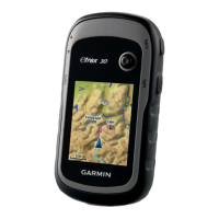
Table of Contents

Other manuals for Garmin eTrex 30

Questions and Answers:

Question and Answer IconNeed help?

Do you have a question about the Garmin eTrex 30 and is the answer not in the manual?

Garmin eTrex 30 Specifications

General IconGeneral
Outdoor (hiking, trekking)Yes
Marine (chartplotters, sounders)No
Routes quantity200
Number of waypoints2000
Form factorHandheld
Display diagonal2.2 \
Display resolution176 x 220 pixels
Display number of colors65536 colors
Display size (HxV) (imperial)1.7 x 1.4 \
Internal memory1740 MB
USB 2.0 ports quantity1
Battery typeAA
Battery life (max)25 h
Battery technologyNickel-Metal Hydride (NiMH)
Number of batteries supported2
Weight and Dimensions IconWeight and Dimensions
Depth33 mm
Width54 mm
Height103 mm
Weight141.7 g

Related product manuals