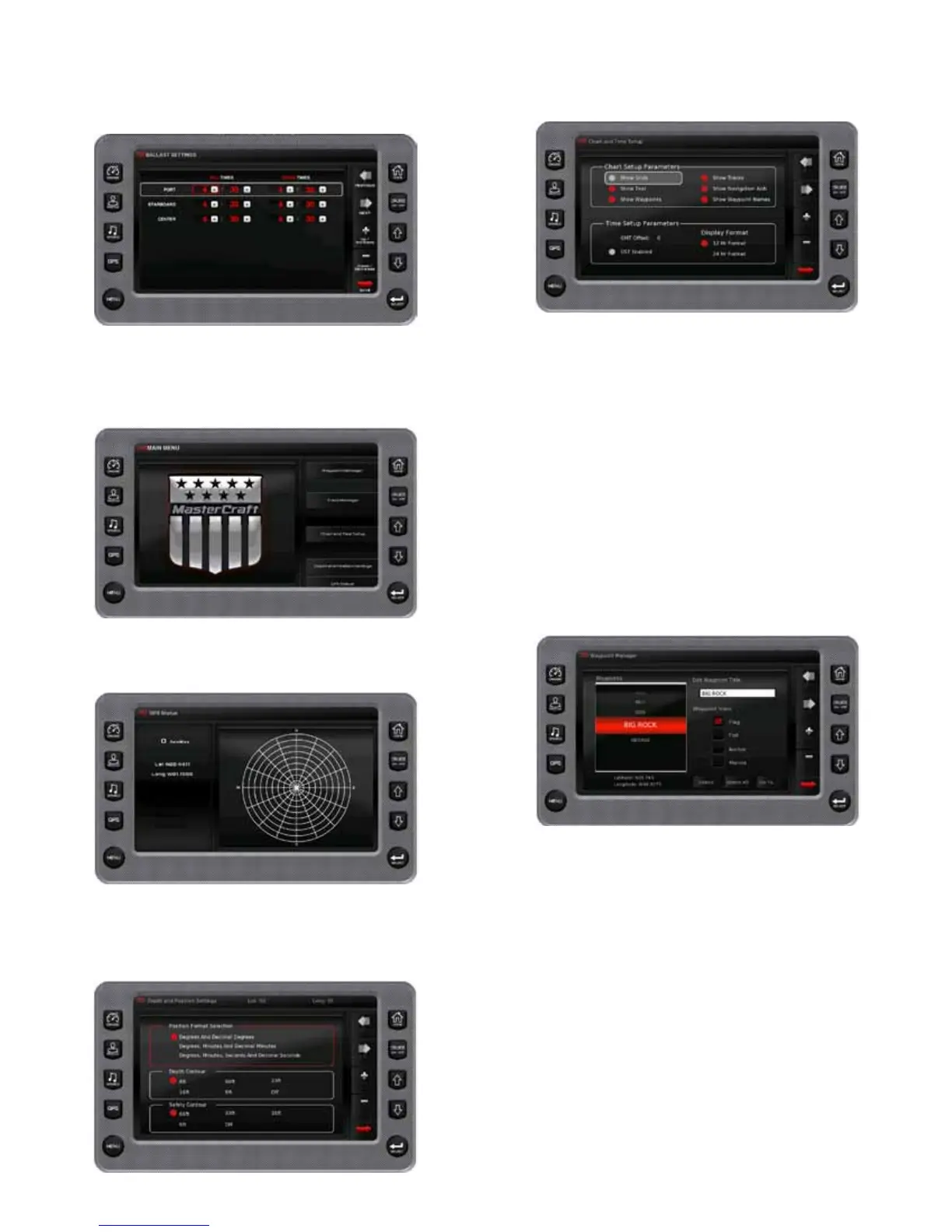
Default Settings
This screen provides various elds for adjusting the values for bal-
last and the smart plate. The Smart plate Crossover point also denes
the threshold for setting the automatic audio volume control.
GPS Utilities
When using a GPS device, GPS Utilities will allow the operator to
congure and monitor satellite tracking data.
Satellite Status
This feature displays a graphic indicating the satellites currently
visible in orbit and the signal strength of each satellite.
Depth and Position Setup
This feature allows the operator to dene the amount of detail to
display for longitude and latitude information on the GPS map and
depth display.
Chart and Time Setup
This menu option allows the operator to set up viewing options for
the GPS Display.
Chart Setup Parameters. Use the CHECK/UNCHECK soft key to se-
lect the information to be displayed on the GPS screen.
Time Setup Parameters
Time Setup Parameters is used to select the correct time zone and
clock mode for either 12-hour or 24-hour time formats. It is also pos-
sible to enable DST (Daylight Savings time) by using the CHECK/UN-
CHECK soft key to select the box.
Waypoint Manager
Waypoints allow the operator to mark specic locations by lati-
tude and longitude. After the waypoints are established, the Waypoint
Manger allows the operator to associate an icon with them for identi-
cation. Use the DELETE key to delete a single waypoint, or DELETE
ALL to remove all of them at once.
Waypoint List displays a list of the waypoints that have been set. Use
the UP and DOWN keys to highlight the desired waypoint.
Waypoint Icon allows the operator to assign one of four dierent
icons to any of the waypoints listed.
Lat/Lon displays the latitude and longitude values for the currently
highlighted waypoint on the list.
MasterCraft 2012 Owners Manual • Guide to Individual Models • Page 2-52
 Loading...