receiver. A higher gure signies a greater
positional error. A typical receiver has an accuracy
of between 5 and 15 m. As an example, assuming
a receiver error of 5 m, an HDOP of 2 would
represent an error of approximately 15 m. Please
remember that even a very low HDOP gure is
NO guarantee that your receiver is providing an
accurate position. If in doubt, check the displayed
vessel position in the Chart application against
your actual proximity to a known charted object.
• Estimated Horizontal Position Error (EHPE)
— EHPE is a measure of the estimated error of
a position x in the horizontal plane. The value
displayed indicates that your position is within a
circle radius of the stated size 50% of the time.
• Fix status — indicates the actual mode the
receiver is reporting:
– Fix — Satellite x has been acquired.
– No Fix — No satellite x can be acquired.
– D Fix — A differential beacon x has been
acquired.
– SD Fix — A differential satellite x has been
acquired.
• Position — Displays the latitude and longitude
position of your receiver.
• Date / Time — Displays the current date and time
generated by the position x in UTC format .
• Mode — Identies wether the receiver is working
in differential mode or non-differential mode.
• Datum — The receiver's datum setting affects
the accuracy of the vessel position information
displayed in the Chart application. In order for your
receiver and MFD to correlate accurately with your
paper charts, they must be using the same datum.
Checking GPS operation
You can check that the GPS is functioning correctly
using the Chart application.
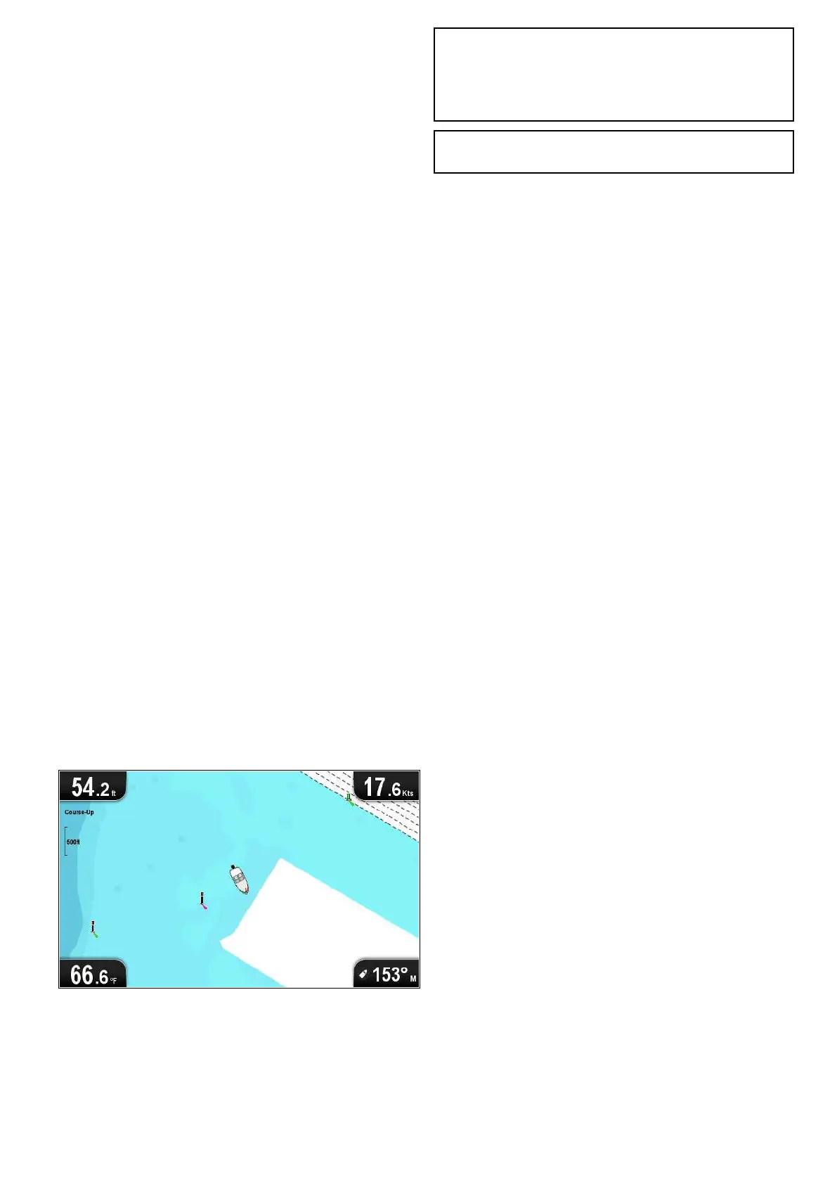
1. Open the Chart application.
2. Check the screen.
You should see:
Your vessel position (indicates a GPS x).
Your current position is represented by a vessel
symbol or solid circle.
A solid circle on the chart indicates that the
vessel speed is too low (i.e. less than 0.15 kts) to
provide Course Over Ground (COG) data.
Note: It is recommended that you check the
displayed vessel position in the Chart application
against your actual proximity to a known charted
object. GNSS receivers typically have an accuracy
of between 5 m and 15 m.
Note: A GPS Status screen provides satellite
signal strength and other relevant information.
Getting started
43
 Loading...