EasyManuals Logo

Garmin StreetPilot c340 User Manual

Garmin StreetPilot c340
44 pages
To Next Page IconTo Next Page
To Previous Page IconTo Previous Page
Page #24 background imageLoading...
Page #24 background image
Garmin © 2005 20 c340 Owner’s Manual
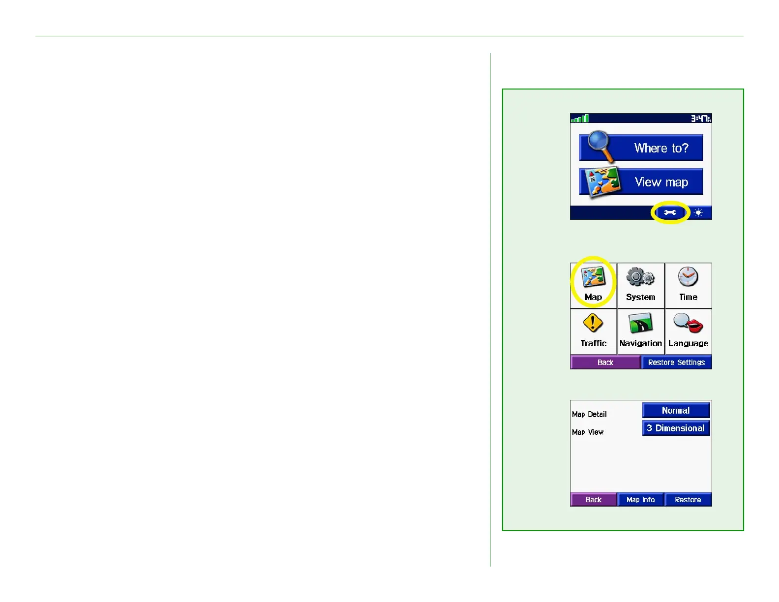
CUSTOMIZING THE C340
Changing Map Settings
Map Detail—adjust the amount of detail shown on the map.
Displaying more detail causes the map to redraw slowly.
Map View—change the perspective of the Map page.
Track Up—display the map in 2 dimensions (2-D) with your
direction of travel at the top.
North Up—display the map in 2-D with North at the top.
3 Dimensional—display the map in 3 dimensions (3-D),
Track Up orientation. This is the default map view.
Map Info—list the maps loaded on your c340. Refer to this when
you are ready to update your map software.
Restore—restore the original map settings.

Other manuals for Garmin StreetPilot c340

Questions and Answers:

Question and Answer IconNeed help?

Do you have a question about the Garmin StreetPilot c340 and is the answer not in the manual?

Garmin StreetPilot c340 Specifications

General IconGeneral
AutoYes
Marine (chartplotters, sounders)No
Routes quantity0
Number of waypoints500
Form factorPlug-in
Product colorGray
Display resolution320 x 240 pixels
Internal memory type-
Battery life (max)8 h
Weight and Dimensions IconWeight and Dimensions
Depth72 mm
Width113 mm
Height82 mm
Weight269 g

Related product manuals