GR30/GM30/GR50, Technical Data
62
9 Technical Data
9.1 GR30/GM30/GR50 Technical Data
9.1.1 Tracking Characteristics
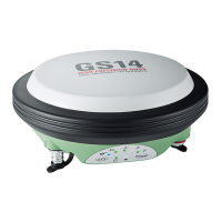
Instrument
technology
Leica patented SmartTrack+ technology
• Advanced measurement engine generation 7 (555 universal tracking channels,
flexible number of signals per satellite, more than 240 satellites multifrequency)
• Excellent resistance to interference for consistent, accurate and reliable meas-
urement data
• Industry leading Pulse Aperture Correlator (PAC) multipath mitigation technology
for superior quality measurements
• Excellent low elevation tracking
• Very low noise GNSS carrier phase measurements with <0.5 mm precision
• Minimum acquisition time
Satellites’ signals
tracking
The following satellite signals are tracked:
• GPS: L1, L2P(Y), L2C, L5
• GLONASS: L1, L2P, L2C
1
• Galileo: E1, E5a, E5b, AltBOC
1
• BeiDou: B1, B2, B3
1
• QZSS: L1, L2C, L5
• SBAS: L1 from WAAS, EGNOS, GAGAN, MSAS
Time for initial acquisition of signals
Cold start
2
< 40 s (typical)
Hot start
3
< 30 s (typical)
Time for reacquisition of signals
L1 < 0.5 s (typical)
L2 < 1.0 s (typical)
Sensitivity
Initial acquisition (cold): 41 dB-Hz
Initial acquisition (hot): 39 dB-Hz
Reacquisition: 30 dB-Hz
Tracking GNSS L1
4
and L2
5
: 28 dB-Hz
Tracking GNSS L5
6
: 31 dB-Hz
1
The hardware is also prepared for new signals such as GLONASS L3, Galileo E6, IRNSS L5 and L5 CDMA and
is designed for BeiDou Phase 2, Phase 3, B1, B2 and B3 compatibility. The firmware will be enhanced to
support such new signals as soon as the officially published signal interface control documentation (ICD)
becomes available and the systems operational constellation allows for commercial practical use. Gener-
ally, the tracking capability for a specific satellite system is based on publicly available information. For
cases where public information is subject to change or not yet available, Leica Geosystems cannot guar-
antee that these receivers will be fully compatible with a future generation of satellites or signals.
2
Typical value. No almanac or ephemerides and no approximate position or time.
3
Typical value. Almanac and recent ephemerides saved and approximate position and time entered.
4
GNSS L1 represents GPS L1 C/A, GPS L1C, GLONASS L1 C/A, Galileo E1 and BeiDou B1.
5
GNSS L2 represents GPS L2P(Y), GPS L2C, GLONASS L2P and GLONASS L2 C/A.
6
GNSS L5 represents GPS L5, GLONASS L3, GLONASS L5, Galileo E5a, Galileo E5bm Galileo AltBoc and
BeiDou B2.
 Loading...