
Do you have a question about the Skydio X2D and is the answer not in the manual?
| Camera Resolution | 12 MP |
|---|---|
| Flight Time | 35 minutes |
| Aircraft Type | Quadcopter |
| Ingress Protection | IP54 |
| Visual Sensors | 6x 4K navigation cameras |
| Gimbal | 3-axis stabilized |
| Main Camera Sensor | 1/2.3" CMOS |
| Zoom Camera | Yes |
| Thermal Camera | Yes |
| Thermal Camera Resolution | 320 x 256 |
| GNSS | GPS, GLONASS |
| Obstacle Avoidance | 360° Obstacle Avoidance |
| Maximum Transmission Range | 10 km |
| Weight | 1.3 kg (2.9 lbs) |
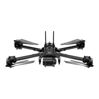
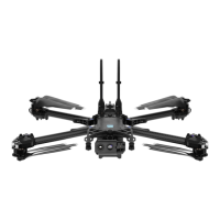
Overview of the Skydio X2 drone and its accompanying accessories.
Details on the AEF software add-on and necessary extra equipment.
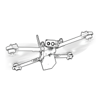
Identification and description of the Skydio X2 drone's components.
Essential safety rules and precautions for operating the drone.
Guidelines on appropriate locations and conditions for drone flight.
Initial steps and recommendations for the drone's first flight.
Instructions for charging the drone and controller, and assembling the drone.
Process for connecting the Skydio X2 drone and its controller.
Verifying that the drone and controller software are up-to-date.
Importing maps and planning waypoint missions for drone navigation.
Checklist for inspecting the drone's condition and readiness for flight.
Setting up critical drone and controller configurations before flight.
Configuring operational parameters for the Skydio X2 drone, including height, obstacle avoidance, and GPS Night Flight.
Configuring settings for the Skydio Enterprise Controller, including flight controls, speed, and mode.
Steps for safely launching the Skydio X2 drone into the air.
Overview of the drone's primary flight interface and its elements like indicators and camera settings.
Accessing and customizing various intelligent flight skills such as Manual, Waypoints, and Orbit.
Using digital zoom features with the drone's color and thermal cameras.
Customizing how the drone returns to its home location, including height and behavior.
Selecting between GPS or visual navigation for drone return based on environment.
Procedures for safely landing the drone into its protective case.
Viewing and transferring captured photos and videos from the drone.
Steps for safely taking apart the drone and controller for storage or transport.
Detailed instructions for operating the drone in GPS Night Flight mode.
Important safety notes for GPS Night Flight, including obstacle avoidance and visibility.
Step-by-step guide for safely launching the drone from hand.