03 Advanced user settings
Menus
03
42
General
When the navigation system starts up the
required user settings are selected
Advanced.
Access to all of the navigation system's set-
tings and functions is available in the
Advanced mode.
Main menu
The main menu is at the top of the menu tree
and can be reached by pressing the BACK
button one or more times.
It is possible to switch from
Advanced to
Easy user settings in the main menu under:
Settings System options User mode
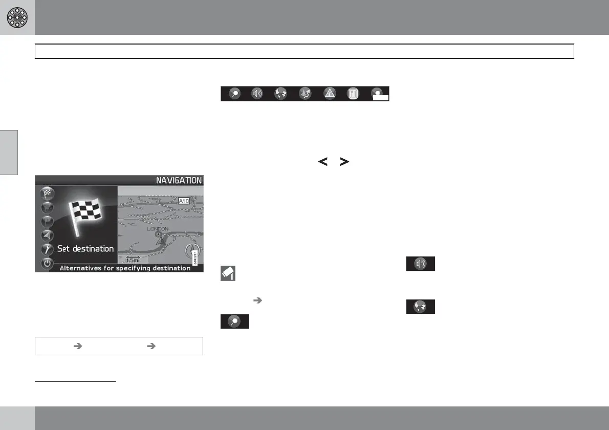
Quick menu
G029190
The most common functions are collected
together in the Quick menu, which makes them
easier to access while driving.
1.
Press ENTER in Map mode.
2.
Select a symbol using
or .
Most system settings can be made under
Settings in the Main menu while others can
only be accessed via the Quick menu.
Fast storage of current location
You can save the location of your car to the
map at any one time at the touch of a button.
•
Press ENTER - hold down the button until
the display changes.
Your location will then be stored, as indi-
cated by this symbol. Information linked
with the position is adjusted via Stored
location
Edit, see page 50.
G028755
- Route outline/Scale
A menu containing four options is displayed.
Pressing ENTER on the option at the top dis-
plays a map showing the remaining route out-
line
1
from the current position to the destina-
tion.
Pressing ENTER on the second option dis-
plays a map showing the entire route outline
1
from start to destination.
Pressing ENTER on the options (+) or (-)
changes the map scale in various stages, from
50 metres up to 100 km, to give you a greater
perspective or allow you to see more details.
Stepless changing is possible if you hold down
ENTER - release the button when the scale is
suitable.
If you opt to display two maps, the map scale
symbol appears at either end of the Quick
menu so that you can adjust the relevant scale
individually.
G028755
– Guidance
Pressing ENTER provides current voice guid-
ance.
G028755
– Map/Route outline
Route outline
Pressing ENTER displays a list of approaching
waypoints. The distance between waypoints
and type of manoeuvre are displayed in addi-
tion to the road name.
1
A route must be selected.
 Loading...