1. OPERATIONAL OVERVIEW
1-4
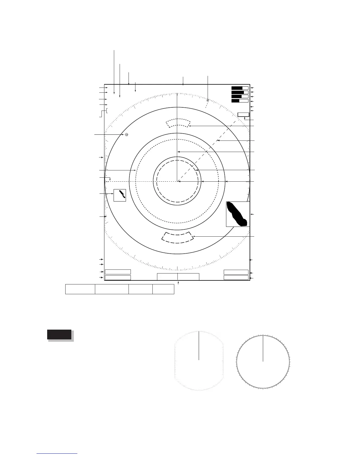
1.3 Display Indications
Display indications
The screen configuration, chosen
during the installation, is available
in three types, “Sea”, “River” and
“IEC”, and the default configuration
is “Sea”. The majority of the
descriptions in this manual use the
“Sea” configuration. The major dif-
ference between the Sea, River
and IEC configurations is the effec-
tive display area - it is elliptical on
the Sea and River types and cir-
cular on the IEC type.
Heading
OWN LAT: 34
°
56.123 N
SHIP LON: 135
°
34.567 E
SPEED 12.3 kt
CURSOR LAT: 34
°
56.123 N
LON: 135
°
34.567 E
TTG: 01:00
TEMP 12.3
°
C
DEPTH 56.7 m
WAY 14.90 NM
POINT 202.4
°
TTG: 00:20
Nav data:
Appears at screen bottom when Data Box in the
Display sub menu is set to "Nav" or "All". Appropriate sensors
required to display nav data.
Cursor data
(Range and bearing or L/L position)
Presentation mode
Range ring interval
Custom setting name
Range
Pulse length
Echo stretch (ES),
Echo averaging (EAV)
Noise rejector (NR),
Interference rejector (IR)
Zoom
Trail reference
Trail time
No.1 EBL bearing
Offcenter
(M: Manual, A: Auto)
Auto adjustment of
rain and sea clutters
North Marker
TUNE indicator
GAIN indicator
A/C SEA indicator
A/C RAIN indicator
2nd echo rejector
Target alarm
indications
No. 1 VRM range
No. 2 VRM range
WATCHMAN
Target alarm zone 1
Target alarm zone 2
359.9°
M
+ 242.8°R 2.782 NM
ALARM1_IN
ALARM2_OUT
VRM2 0.220NM
VRM1>0.425<NM
TRAILS (T)
15S
EBL2 45.0°
R
EBL1>270.0°R<
+

 Loading...