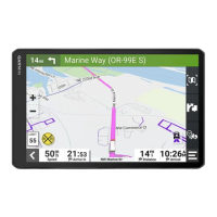
Using the myTrends
™
feature, your device predicts your
destination based on your travel history, the day of the week,
and the time of day. After you have driven to a saved location
several times, the location may appear in the navigation bar on
the map, along with the estimated time of travel, and traffic
information.
Select the navigation bar to view a suggested route to the
location.
Avoiding Delays, Tolls, and Areas
Avoiding Traffic Delays on Your Route
Before you can avoid traffic delays, you must be receiving traffic
information (Receiving Traffic Data Using Smartphone Link,
page 14).
By default, the device optimizes your route to avoid traffic delays
automatically. If you have disabled this option in the traffic
settings (Traffic Settings, page 23), you can view and avoid
traffic delays manually.
1
While navigating a route, select > Traffic.
2
Select Alternate Route, if available.
3
Select Go!.
Avoiding Toll Roads
Your device can avoid routing you through areas that require
tolls, such as toll roads, toll bridges, or congestion areas. The
device may still include a toll area in your route if no other
reasonable routes are available.
1
Select > Navigation > Route Preferences.
2
Select an option:
NOTE: The menu changes based on your area and the map
data on your device.
• Select Toll Roads.
• Select Tolls and Fees > Toll Roads.
3
Select an option:
• To be asked each time before routing through a toll area,
select Always Ask.
• To always avoid tolls, select Avoid.
• To always allow tolls, select Allow.
4
Select Save.
Avoiding Toll Stickers
If the map data on your device contains detailed toll sticker
information, you can avoid or allow roads that require toll
stickers for each country.
NOTE: This feature is not available in all areas.
1
Select > Navigation > Route Preferences > Tolls and
Fees > Toll Stickers.
2
Select a country.
3
Select an option:
• To be asked each time before routing through an area that
requires toll stickers, select Always Ask.
• To always avoid roads that require toll stickers, select
Avoid.
• To always allow roads that require toll stickers, select
Allow.
4
Select Save.
Avoiding Road Features
1
Select > Navigation > Route Preferences > Avoidances.
2
Select the road features to avoid on your routes, and select
OK.
Avoiding Environmental Zones
Your device can avoid areas with environmental or emissions
restrictions that may apply to your vehicle. This option applies to
the vehicle type in the active vehicle profile (Vehicle Profiles,
page 2).
1
Select > Navigation > Route Preferences >
Environmental Zones.
2
Select an option:
• To be asked each time before routing through an
environmental zone, select Always Ask.
• To always avoid environmental zones, select Avoid.
• To always allow environmental zones, select Allow.
3
Select Save.
Custom Avoidances
Custom avoidances allow you select specific areas or sections
of road to avoid. When the device calculates a route, it avoids
these areas and roads unless no other reasonable route is
available.
Avoiding a Road
1
Select > Navigation > Route Preferences > Custom
Avoidances.
2
If necessary, select Add Avoidance.
3
Select Add Avoid Road.
4
Select the starting point of the section of road to avoid, and
select Next.
5
Select the ending point of the road section, and select Next.
6
Select Done.
Avoiding an Area
1
Select > Navigation > Route Preferences > Custom
Avoidances.
2
If necessary, select Add Avoidance.
3
Select Add Avoid Area.
4
Select the upper-left corner of the area to avoid, and select
Next.
5
Select the lower-right corner of the area to avoid, and select
Next.
The selected area is shaded on the map.
6
Select Done.
Disabling a Custom Avoidance
You can disable a custom avoidance without deleting it.
1
Select > Navigation > Route Preferences > Custom
Avoidances.
2
Select an avoidance.
3
Select > Disable.
Deleting Custom Avoidances
1
Select > Navigation > Route Preferences > Custom
Avoidances.
2
Select an option:
• To delete all custom avoidances, select .
• To delete one custom avoidance, select the avoidance,
and select > Delete.
Finding and Saving Locations
The maps loaded in your device contain locations, such as
restaurants, hotels, auto services, and detailed street
information. The Where To? menu helps you find your
destination by providing several methods to browse, search, and
save this information.
6 Finding and Saving Locations
 Loading...