eTrex H Owner’s Manual 7
MaIn PaGeS
MaIn PaGeS
Information needed to operate the eTrex is found on
five main pages. Press PAGE to cycle through the
pages.
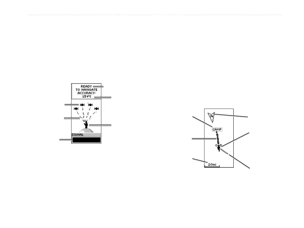
SkyView Page
Your
location
Status message
Satellites
The SkyView Page
Satellite
signal
strength bar
Satellite
signals
Location
accuracy
(estimated)
The SkyView page displays the GPS receiver status.
It also shows the strength of the satellite signals. A
READY TO NAVIGATE message is shown when the
receiver has gathered enough satellite information to
begin navigation.
SkyView Page Options
To view the options menu, press ENTER.
Setup Display—change the display contrast
and set the length of time that the backlight will
stay on.
Advanced SkyView—select the Advanced
SkyView feature to view a page containing
detailed information on the satellites.
Map Page
Your location
North pointer
Path to
destination
Destination
waypoint
Map
scale
Trail
(Track Log)
The Map Page
The Map page shows where you are located, and as
you travel, the animated gure leaves a track log. The
map also shows waypoint names and symbols.
•
•

 Loading...