
Do you have a question about the Casio WSD-F20 and is the answer not in the manual?
| Resolution | 320 x 300 pixels |
|---|---|
| Touchscreen | Yes |
| Charging Method | Magnetic charging terminal |
| Memory | 512 MB RAM |
| Processor | Qualcomm Snapdragon Wear 2100 |
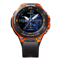
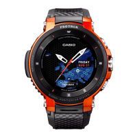
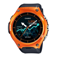
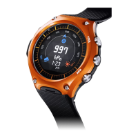
| Colors | Orange, Black |
| Display | 1.32-inch dual-layer display |
| Operating System | Wear OS by Google |
| Water Resistance | 50 meters (5 ATM) |
| Sensors | Accelerometer, Gyrometer, Compass, Pressure Sensor |
| Connectivity | Bluetooth 4.1, Wi-Fi |
| Weight | 92 g |
| GPS | Yes |
| Storage | 4GB |
| Battery | Lithium-ion |
| Battery Life | 1-2 days (Smart Mode), 1 month (Timepiece Mode) |