NX501/NZ501 English 12
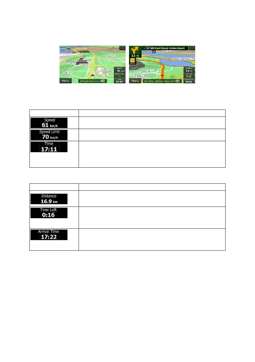
Tap any of the data fields to suppress others and display only the selected one. The data fields are
different when you are navigating an active route and when you have no specified destination (the orange
line is not displayed).
Default data fields when cruising without a destination (tap and hold any of the fields to change its value):
Field Description
Shows your current speed given by the GPS receiver.
Shows the speed limit of the current road if the map contains it.
Shows the current time corrected with time zone offset. The accurate time
comes from the GPS satellites, and the time zone information comes from the
map or it can be set manually in Regional settings.
(The current time is always displayed in the top left corner of menu screens.)
Default data fields when navigating a route (tap and hold any of the fields to change its value):
Field Description
Shows the distance you need to travel on the route before reaching your final
destination.
Shows the time needed to reach the final destination of the route based on
information available for the remaining segments of the route.
The calculation cannot take into account traffic jams and other possible delays.
Shows the estimated arrival time at the final destination of the route based on
information available for the remaining segments of the route.
The calculation cannot take into account traffic jams and other possible delays.
2.2.2 Position markers
2.2.2.1 Vehimarker and Lock-on-Road
When your GPS position is available, Clarion Mobile Map marks your current position with the Vehimarker.
By default, this marker is a red arrow, but you can change this icon in Settings.
 Loading...