Garmin G1000 Pilot’s Guide for the Piper PA-32 Saratoga
190-02692-00 Rev. A
94
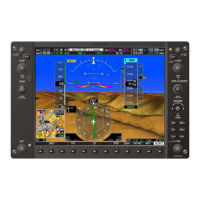
ENGINE INDICATION SYSTEM
SYSTEM
OVERVIEW
FLIGHT
INSTRUMENTS
EIS
AUDIO PANEL
& CNS
FLIGHT
MANAGEMENT
HAZARD
AVOIDANCE
AFCS
ADDITIONAL
FEATURES
APPENDICESINDEX
6
Cabin Temperature Displays the temperature inside the cabin in degrees Fahrenheit (°F).
7
Fuel Quantity Displays left (L FUEL QTY) and right (R FUEL QTY) fuel quantity in gallons (GAL).
8
Oil Group Displays oil temperature in degrees Fahrenheit (°F) and oil pressure in pounds per square
inch (PSI).
9
Fuel Flow Displays fuel flow in gallons per hour (GPH).
FUEL CALCULATIONS
NOTE: Fuel calculations do not use the aircraft fuel quantity indicators and are calculated from the last time
the fuel was reset.
Fuel calculations are based on the fuel flow totalizer and the displayed fuel remaining (GAL REM), adjusted
using the following softkeys:
• DEC FUEL – Decreases totalizer-based fuel remaining in one-gallon increments
• INC FUEL – Increases totalizer-based fuel remaining in one-gallon increments
• RST FUEL – Resets totalizer-based fuel remaining to 102 gallons and fuel used display to zero
A map feature related to the EIS Fuel Calculations is the Fuel Range Ring, which graphically illustrates the
aircraft’s remaining range based heading, groundspeed, and wind direction and speed.
The Fuel Range Ring shifts position in relation to the aircraft according to the current calculated wind effects.
For example, more fuel is required for flying into a headwind, and the aircraft’s decreased range in that direction
is indicated by the Fuel Range Ring shifting toward the tail of the Aircraft Symbol. However, it does not
calculate forecasted winds and weather from the datalink.
The amount of reserve fuel (only for purposes of the Fuel Range Ring) is set on the Navigation Map Page
Setup Menu in terms of remaining flight time. When enabled the Fuel Range Ring appears on the Navigation
Map Page, the Weather Data Link Page, and PFD Inset Map.
Enabling/disabling the Fuel Range Ring and selecting a reserve fuel time:
1) Display the Navigation Map screen.
2) Press the MENU Key.
3) Highlight ‘Map Settings and press the ENT Key. The Map Settings Menu is displayed.
4) Use the small FMS Knob to select the ‘Map’ group and press the ENT Key.
5) Highlight the FUEL RNG (RSV) field.
6) Turn the small FMS Knob to select ‘On’ or ‘Off’.
7) Turn the large FMS Knob to highlight the reserve fuel time, how long the aircraft can fly after reaching the
reserve fuel.
8) Enter the desired reserve fuel time (00:00 to 23:59; hours:minutes) and press the ENT Key.
9) Press the FMS Knob to return to the Navigation Map Screen.
 Loading...