190-02692-00 Rev. A
Garmin G1000 Pilot’s Guide for the Piper PA-32 Saratoga
15
SYSTEM OVERVIEW
SYSTEM
OVERVIEW
FLIGHT
INSTRUMENTS
EIS
AUDIO PANEL
& CNS
FLIGHT
MANAGEMENT
HAZARD
AVOIDANCE
AFCS
ADDITIONAL
FEATURES
APPENDICES INDEX
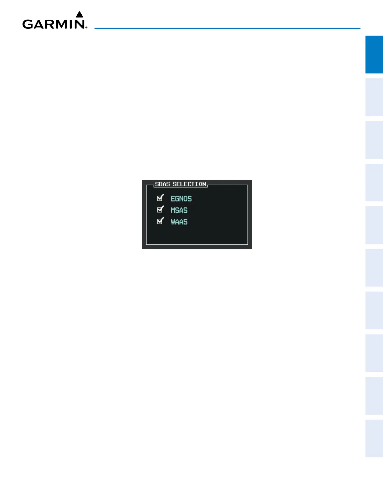
SBAS SELECTION
In certain situations, such as when the aircraft is outside or on the fringe of the SBAS coverage area, it may
be desirable to disable SBAS (although it is not recommended). When disabled, the SBAS Field in the GPS
STATUS Box indicates DISABLED.
Disabling SBAS
1) Use the FMS Knob to select the AUX – GPS STATUS Page.
2) If necessary, press the SBAS Softkey.
3) Push the
FMS
Knob to activate the cursor
.
4) Turn either FMS Knob to select ‘EGNOS’ or ‘MSAS’ or ‘WAAS’, as necessary.
5) Press the ENT Key to uncheck the box.
6) Repeat steps 4 & 5 as necessary, then push the FMS Knob to remove the cursor.
Figure 1-10 Enable/Disable SBAS
GPS SATELLITE SIGNAL STRENGTHS
The AUX – GPS STATUS Page can be helpful in troubleshooting weak (or missing) signal levels due to
poor satellite coverage or installation problems. As the GPS receiver locks onto satellites, a signal strength
bar is displayed for each satellite in view, with the appropriate satellite PRN number (01-32 or 120-138 for
SBAS) below each bar. The progress of satellite acquisition is shown in three stages, as indicated by signal
bar appearance:
» No bar—Receiver is looking for the indicated satellite
» Hollow bar—Receiver has found the satellite and is collecting data
» Cyan bar—Receiver has collected the necessary data and the satellite signal can be used
» Green bar—Satellite is being used for the GPS solution
» Checkered bar—Receiver has excluded the satellite (Fault Detection and Exclusion)
» ‘D’ indication—Denotes the satellite can be used as part of the differential computations
Each satellite has a 30 second data transmission that must be collected (signal strength bar is hollow) before
the satellite may be used for navigation (signal strength bar becomes solid).

 Loading...