190-02692-00 Rev. A
Garmin G1000 Pilot’s Guide for the Piper PA-32 Saratoga
155
FLIGHT MANAGEMENT
SYSTEM
OVERVIEW
FLIGHT
INSTRUMENTS
EIS
AUDIO PANEL
& CNS
FLIGHT
MANAGEMENT
HAZARD
AVOIDANCE
AFCS
ADDITIONAL
FEATURES
APPENDICES INDEX
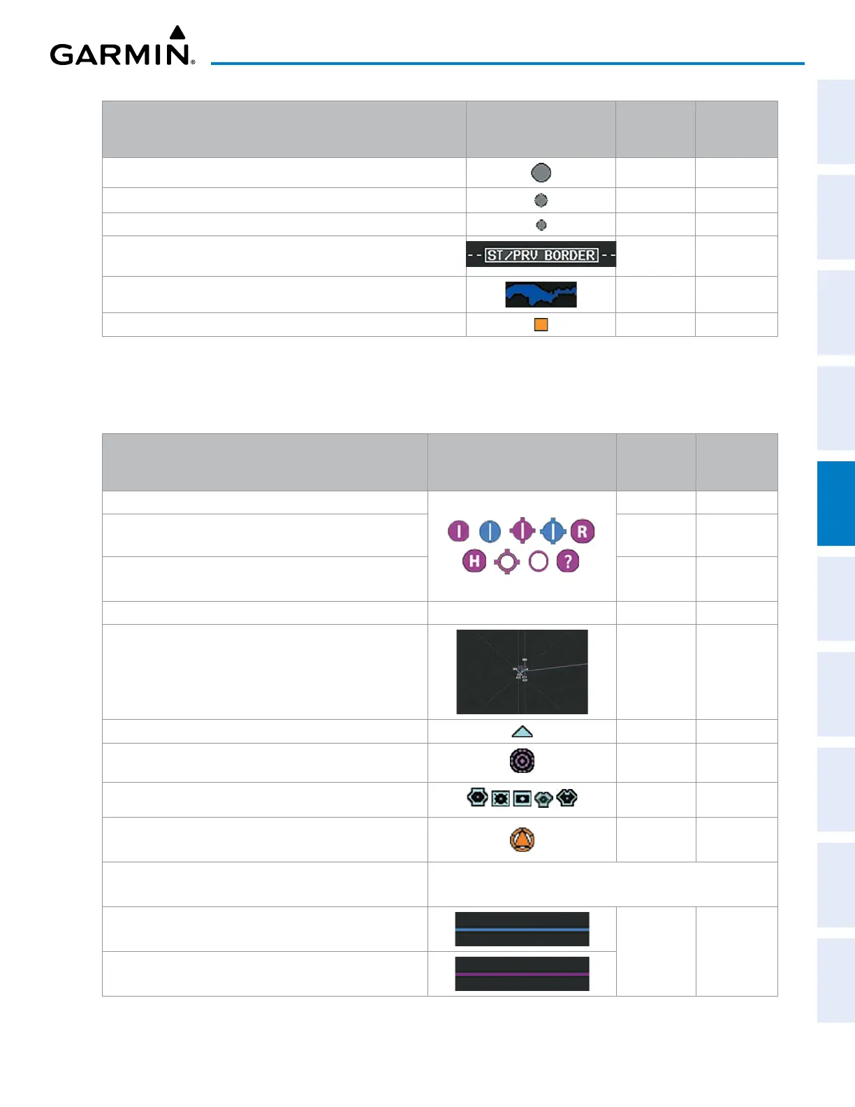
Land Symbols
(Text label size can be None, Small, Medium (Med), or Large
(Lrg))
Symbol Default
Range (nm)
Maximum
Range (nm)
LARGE CITY (> 200,000) 800 1500
MEDIUM CITY (> 50,000) 100 200
SMALL CITY (> 5,000) 20 50
States and Provinces (STATE/PROV) 800 1500
Rivers and Lakes (RIVER/LAKE) 200 500
USER WAYPOINT 150 300
Table 5-1 Land Symbol Information
AVIATION SYMBOLS
The following items are configured on the aviation menu:
Aviation Symbols
(Text label size can be None, Small, Medium (Med),
or Large (Lrg))
Symbol Default
Range (nm)
Maximum
Range (nm)
Large Airports (LARGE APT) (Longest Runway ≥ 8100 ft)
200 500
Medium Airports (MEDIUM APT) (8100 ft > Longest
Runway ≥ 5000 ft)
150 300
Small Airports (SMALL APT) (Longest Runway < 5000 ft)
(Medium Airport if it has a tower frequency)
50 100
Taxiways (SAFETAXI) See Additional Features 3 20
Runway Extension (RWY EXTENSION) Off 100
Intersection (INT WAYPOINT) 15 30
Non-directional Beacon (NDB WAYPOINT) 15 30
VOR (VOR WAYPOINT)
150 300
VRP (VRP WAYPOINT) 15 30
CL B/TMA/AWY (see below)
Class B (CL B) and Terminal Manoeuvring Area (TMA)**
200 500
Airway (AWY)**

 Loading...