Garmin G1000 Pilot’s Guide for the Piper PA-32 Saratoga
190-02692-00 Rev. A154
FLIGHT MANAGEMENT
SYSTEM
OVERVIEW
FLIGHT
INSTRUMENTS
EIS
AUDIO PANEL
& CNS
FLIGHT
MANAGEMENT
HAZARD
AVOIDANCE
AFCS
ADDITIONAL
FEATURES
APPENDICESINDEX
Displaying/removing the topographic scale (TOPO SCALE):
1) Press the MENU Key with the MAP – NAVIGATION MAP Page displayed. The cursor flashes on the ‘Map Setup’
option.
2) Press the ENT Key. The MAP SETUP Window is displayed.
3) Select the ‘Map’ Group and press the ENT Key.
4) Highlight the TOPO SCALE Field.
5) Select ‘On’ or ‘Off’.
6) Push the FMS Knob to return to the MAP – NAVIGATION MAP Page.
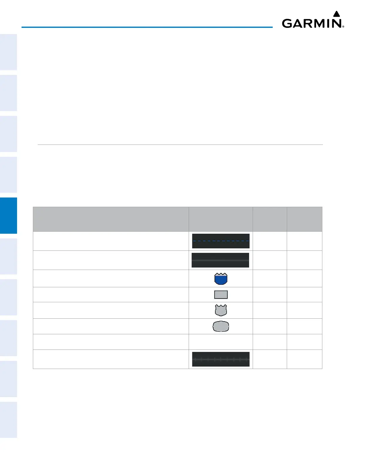
MAP SYMBOLS
This section discusses the types of land and aviation symbols that can be displayed. Each listed type of
symbol can be turned on or off, and the maximum range to display each symbol can be set. The decluttering
of the symbols from the map using the DCLTR Softkey is also discussed.
LAND SYMBOLS
The following items are configured on the land menu:
Land Symbols
(Text label size can be None, Small, Medium (Med), or Large
(Lrg))
Symbol Default
Range (nm)
Maximum
Range (nm)
Latitude/Longitude (LAT/LON) Off 2000
Highways and Roads
Interstate Highway (FREEWAY) 300 800
International Highway (FREEWAY) 300 800
US Highway (NATIONAL HWY) 30 80
State Highway (LOCAL HWY) 15 30
Local Road (LOCAL ROAD)
N/A
8 15
Railroads (RAILROAD) 15 30

 Loading...