EasyManuals Logo

Garmin GPSMAP 62 User Manual

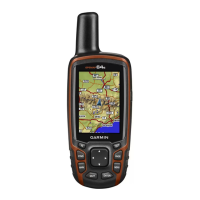
Garmin GPSMAP 62
154 pages
To Next Page IconTo Next Page
To Previous Page IconTo Previous Page
Page #66 background imageLoading...
Page #66 background image
การใช้หน้าหลัก
64
คู่มือการใช้งาน GPSMAP 62/62s
TH
ตัวเลือกการตั้งค่าเข็มทิศ
จากเข็มทิศ กด MENU และเลือก ตั้ง
ค่าทิศทางที่มุ่งไป
แสดงผล—แสดงประเภทของเส้น
ทางที่มุ่งไปบนเข็มทิศ:
อักษรบอกทิศทาง—ตั้งค่าการ
อ่านบนเข็มทิศเป็นตัวอักษรระบุทิศ
(N, S, E, W)
องศา—ตั้งค่าการอ่านบนเข็มทิศ
เป็นองศา (0°-359°)
Mils—ตั้งค่าการอ่านบนเข็มทิศ
เป็น mils (0 mils-6399 mils)
North Reference—ตั้งค่าเข็ม
ทิศให้อ้างอิงไปทางทิศเหนือ:
จริง—ตั้งค่าทิศเหนือจริงเป็นการ
อ้างอิงทิศทางที่มุ่งไป
แม่เหล็ก—ตั้งค่าความลาดเอียง
ของแม่เหล็กสำาหรับตำาแหน่งของ
คุณโดยอัตโนมัติ
Grid—ตั้งค่า Grid ทิศเหนือ
เป็นการอ้างอิงทิศทางที่มุ่งไป (0°)
ผู้ใช้—ตั้งค่าความผันแปรของแม่
เหล็ก
ไปยัง line/ตำาแหน่งนี้—อนุญาต
ให้คุณเลือกว่าจะแสดงเส้นทาง
อย่างไร
ทิศทาง (เล็ก/ใหญ่) ระบุทิศทาง
ไปยังจุดหมายปลายทางของคุณ
เส้นทาง ระบุความสัมพันธ์ของคุณ
กับแนวเส้นทางที่นำาไปยังจุดหมาย
ปลายทางของคุณ
เข็มทิศ—อนุญาตให้คุณเปลี่ยน
จากเข็มทิศอิเล็กทรอนิกส์ไปเป็น
เข็มทิศ GPS ในขณะที่คุณกำาลัง
เดินทางด้วยความเร็วที่สูงขึ้นใน
ช่วงเวลาที่กำาหนด หรือปิดเข็ม
ทิศไป
ปรับตั้งเข็มทิศ—เริ่มการปรับตั้ง
เข็มทิศ (หน้า 63)
190-01215-25_0A.indd 64 2011/3/22 下午 03:12:55

Table of Contents

Other manuals for Garmin GPSMAP 62

Questions and Answers:

Question and Answer IconNeed help?

Do you have a question about the Garmin GPSMAP 62 and is the answer not in the manual?

Garmin GPSMAP 62 Specifications

General IconGeneral
Display resolution160 x 240 pixels
Display typetransflective, 65-K color TFT
Battery type2 AA batteries (not included); NiMH or Lithium recommended
Battery life20 hours
Water ratingIPX7
High-sensitivity receiverYes
InterfaceUSB
BasemapYes
Ability to add mapsYes
Built-in memory1.7 GB
Accepts data cardsmicroSD card (not included)
Waypoints/favorites/locations2000
Routes200
Track log10, 000 points, 200 saved tracks
Electronic compassYes
Barometric altimeterYes
Geocaching-friendlyYes (Paperless)
Custom maps compatibleYes
Picture viewerYes
Garmin Connect compatibleYes
Wireless connectivityNo
GPS receiverYes
Display size2.6 inches
Weight260.1 g with batteries
Physical dimensions6.1 x 16.0 x 3.6 cm

Related product manuals