EasyManua.ls Logo

Garmin Rino 655t User Manual

Garmin Rino 655t
60 pages
To Next Page IconTo Next Page
To Previous Page IconTo Previous Page
Page #16 background imageLoading...
Page #16 background image
Waypoints and Tracks
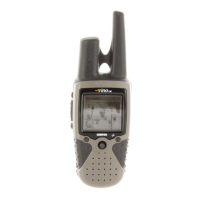
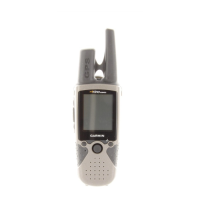
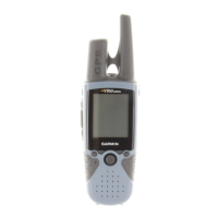
12 Rino 650N Owner’s Manual
About Sharing Data
Your device can send or receive data
when connected to another compatible
device. You can share waypoints,
geocaches, routes, and tracks.
Sending and Receiving Data
Wirelessly
Before you can share data wirelessly
using ANT+
wireless technology, you
must be within 10 feet (3 m) of the
compatible Garmin device.
1. Select .
2. Follow the on-screen instructions.
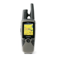
Tracks
A track is a recording of your path.
The track log contains information
about points along the recorded path,
including time, location, and elevation
for each point.
Managing Track Log Recording
1. Select >  > 
.
2. Select ,  or
, .
If you select , 
, a line on the map indicates
your track.
3. Select .
4. Select an option:
To record tracks at a variable
rate that creates an optimum
representation of your tracks,
select .
To record tracks at a specied
distance, select .
To record tracks at a specied
time, select .
5. Select .
6. Select an option to record tracks
more or less often.

Table of Contents

Other manuals for Garmin Rino 655t

Questions and Answers:

Garmin Rino 655t Specifications

General IconGeneral
AviationNo
Sport (fitness, running)-
Marine (chartplotters, sounders)Yes
Routes quantity200
Number of waypoints2000
Channels quantity22 channels
Map coverageUSA
Display diagonal2.6 \
Display resolution160 x 240 pixels
Placement supportedVertical
Display number of colors65536 colors
Display size (HxV) (imperial)1.43 x 2.15 \
Storage media typeFlash
Compatible memory cardsMicroSD (TransFlash)
Internal storage capacity4.5 GB
Form factorHandheld
Product colorGray
Megapixel5 MP
USB 2.0 ports quantity1
Mini-USB 2.0 ports quantity0
Power source typeAC, Battery
Battery life (max)14 h
Cables includedUSB
Weight and Dimensions IconWeight and Dimensions
Depth45 mm
Width60 mm
Height190 mm
Weight320 g

Summary

Getting Started

Initial Setup and Device Basics

Explains manual conventions, registration, keys, antennas, battery, charging, and signal acquisition.

Screen and Backlight Management

Details adjusting backlight brightness and locking the screen.

Radio Operations

Basic Radio Functions

Covers muting the radio and selecting channels.

Radio Settings and Contacts

Explains radio settings, managing contacts, and sending notes.

Peer-to-Peer Positioning and Status

Details sending location and understanding radio status indicators.

Waypoints and Tracks Management

Creating and Managing Waypoints

Covers creating, finding, editing, deleting, and averaging waypoints.

Data Sharing and Track Logging

Explains wireless data sharing and configuring track recording.

Working with Saved Tracks

Details viewing, saving, clearing, deleting, and navigating saved tracks.

Navigation Features

Destination and Track Navigation

Covers navigating to destinations, TracBack, and finding nearby locations.

Map and Compass Usage

Explains map display, compass calibration, and pointer navigation.

Contact and Geocache Navigation

Details navigating to contacts, downloading, and finding geocaches.

Route Planning and Management

Covers creating, editing, viewing, and deleting routes, plus Sight 'N Go.

Emergency Navigation and Control

Explains sending emergency alerts, navigating to them, and stopping navigation.

Customizing Your Device

Screen, Data Fields, and Profiles

Customizes data fields, home screen, profiles, and specific pages.

System and Navigation Settings

Configures GPS, language, units, time, position, heading, altimeter, geocache, routing, and marine settings.

Device Resets and Fitness Options

Covers resetting data, factory defaults, and fitness accessory information.

Device Tools and Utilities

Data Viewing and Measurement Tools

Covers trip computer, elevation plot, calendar, almanacs, and area calculation.

Alarms, Stopwatch, and Photo Viewing

Details setting alarms, using the stopwatch, and viewing photos.

Device Information and Maintenance

Software Updates and Device Specifications

Covers updating software, viewing device info, and technical specifications.

Battery Management and Device Care

Details battery usage, maximizing life, installing AA batteries, and general care.

Connectivity and Data Management

Explains Bluetooth headset connection, microSD card installation, computer connection, and file transfer.

Appendix and Data Field Reference

Optional Hardware and Accessories

Details additional maps, VHF antennas, wired headsets, and fitness accessories.

Data Field Descriptions

Provides detailed explanations for various data fields shown on the device.

Troubleshooting Common Issues

Device Responsiveness and Resetting

Addresses screen unresponsiveness and resetting to factory defaults.

Power, Charging, and Signal Problems

Solves issues with satellite acquisition, charging, and battery life.

Computer Connectivity and USB Issues

Helps diagnose problems with USB mass storage mode and drive recognition.

Related product manuals