5-10 Raynav 300 GPS Plotter
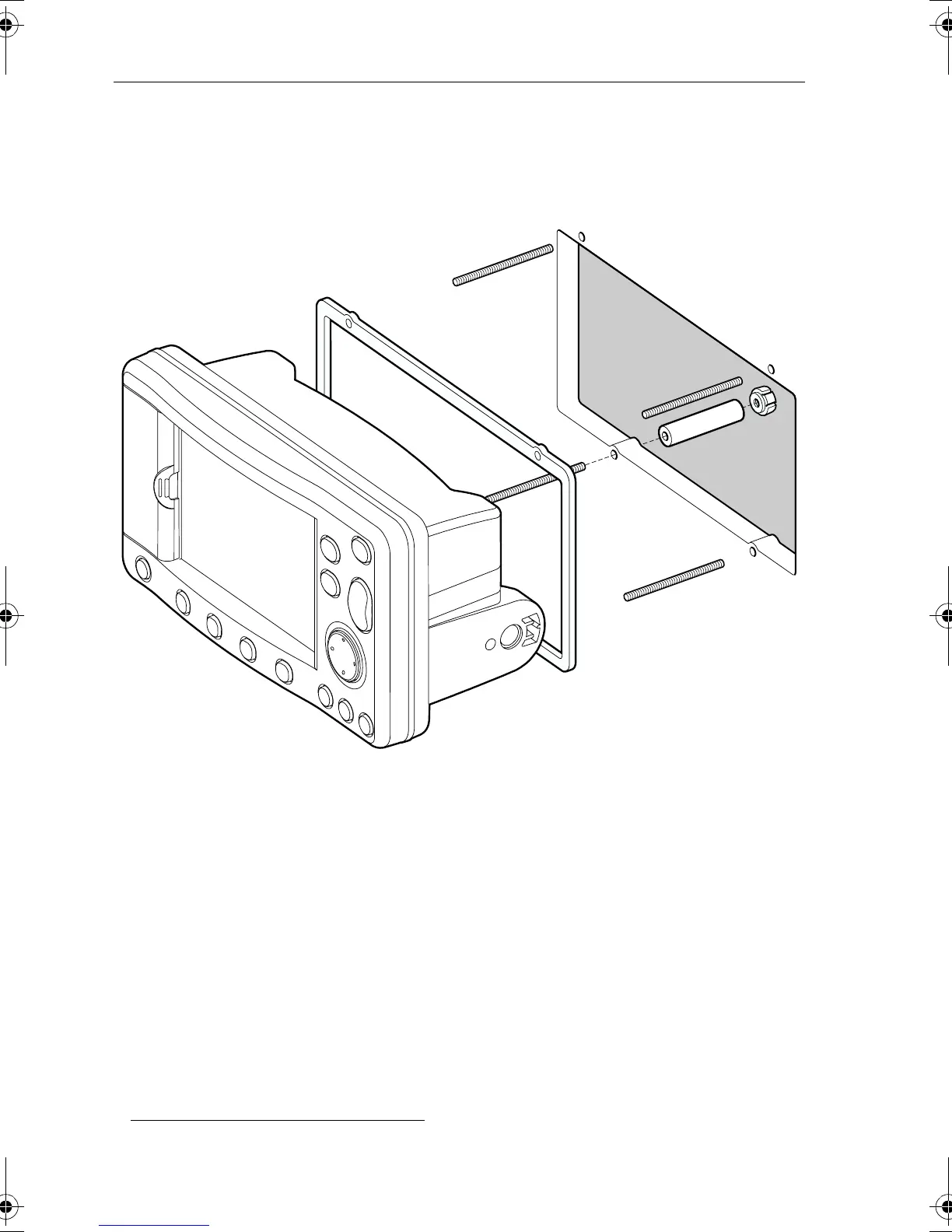
12. Screw the studs into the vacant holes at the rear of the unit, hand tight
only.
13. Slide a spacer ferrule onto each stud.
14. Secure the unit with the thumb nuts, hand tight only.
Figure 5-5: Panel Mounting
5.5 Connecting to Other Equipment
The unit transmits navigation and waypoint data on NMEA
1
and SeaTalk
and, therefore, can be connected to an NMEA compatible autopilot or
instrument repeater(s). The navigation data transmitted and received by
the Plotter is detailed in Appendix B to this handbook.
1. National Marine Electronics Association (NMEA) 0183 interconnection stan-
dard, Version 2.3 April 1998.
D4969-2
81171_4.BOOK Page 10 Thursday, November 29, 2001 11:34 AM
 Loading...