Chapter 3: Operation 3-3
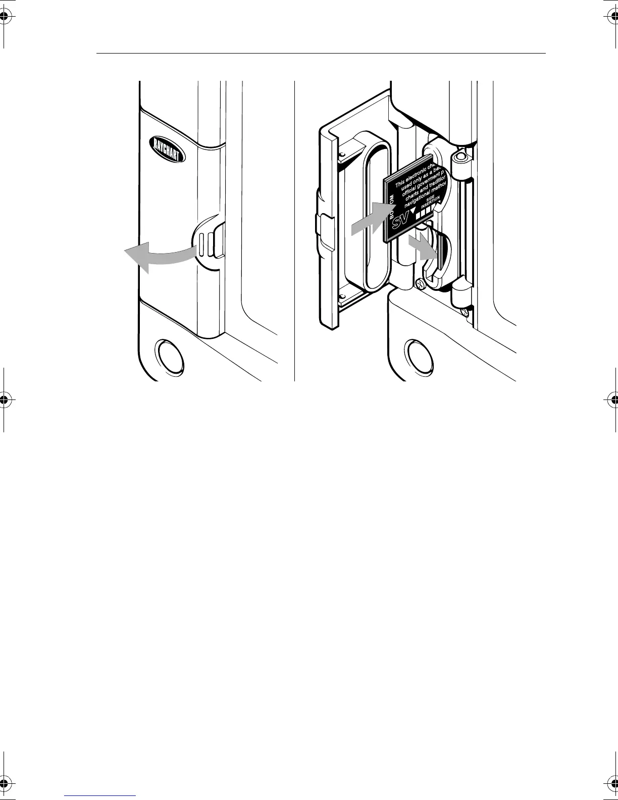
Figure 3-1: Chart Card Insertion/Removal
Removing a Chart Card
➤ Refer to Figure 3-1:
1. Open the card cover at the left of the display front panel.
2. On the card you wish to remove, press down and move the top of the
card to the left to clear the retaining pegs.
The card will spring part-way out, enabling you to grip and remove it
from its slot.
3. To prevent the ingress of water, close the card cover so that it clicks
shut.
Displaying the Chart Data
The new chart information will be displayed when you move the cursor
into an area covered by the new chart or, if it is already in the area, change
the scale.
The boundary of each chart digitized in the current card is defined by a
box or rectangle. (You can switch off the chart boundaries display if you
wish, as part of the chartplotter set up described in Chart Set Up
Parameters on page 4-8).
D4158-1A
81167_3.BOOK Page 3 Wednesday, November 21, 2001 2:12 PM
 Loading...