Chapter 3: Operation 3-31
Displaying Route Information
The following route information can be displayed:
• Full route details, using the soft keys.
• Route leg or waypoint information, using the context-sensitive cursor.
Full Route Details
➤ To display information about any route in the database:
1. Press the
ROUTE soft key, followed by MORE, then press ROUTE LIST.
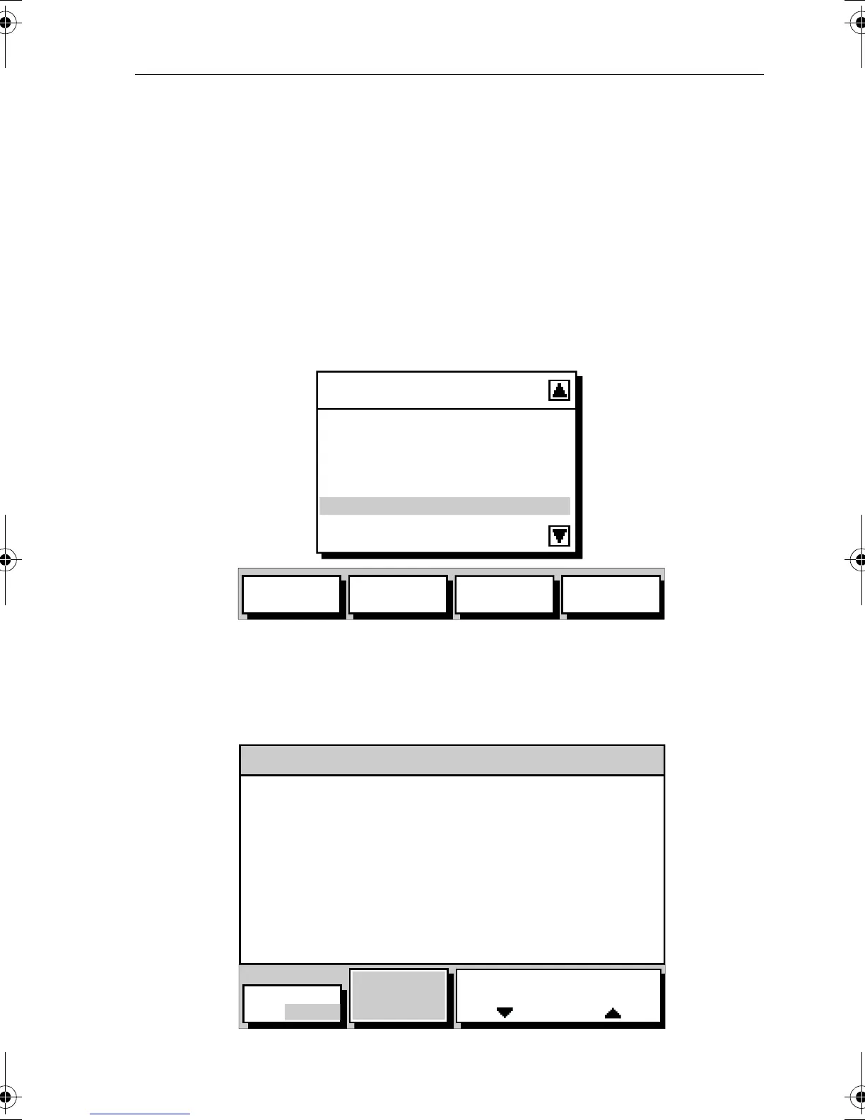
The Route List is displayed with the selected route highlighted as
shown in Figure 3-36.
Figure 3-36: Route List and Soft Keys
2. Use the trackpad up/down to select the required route, then press the
ROUTE INFO soft key.
The Route Information is displayed as shown in Figure 3-37.
Figure 3-37: Route Information Screen
ROUTE LIST
CURRENT
1 ALDERNEY-SOLENT
2 COWES-PORTSMOUTH
3 BRAYE-CHERBOURG
4 ROUND THE WORLD
5 NO NAME
SHOW
ROUTE
ERASE
ROUTE
ROUTE
INFO
NAME
ROUTE
D4916-1
INFO FOR ROUTE - NEW ROUTE
WPT POSITION BRG DISTANCE TOTAL TIME
°T nm nm ETA
01 50°50^00N --- 0.0 0.0 0:00
001°06^00W
02 50°51^00N 239 4.8 4.8 0:20
001°07^00W
ACTUAL
SOG
4.5kts
TIME
ETA HOURS
D4930-3
PLANNED SOG
6.1kts
TIME: 14:03:39 DATE: 10/29/2001
81167_3.BOOK Page 31 Wednesday, November 21, 2001 2:12 PM
 Loading...
