Depending on the map scale selected, spe-
cial destination icons appear on the map.
The scale at which the icons are displayed
on the map varies according to the icon.
You can select the icons thatCOMAND will
display (Y page 85).
No special destinations are available:
You will see a message to this effect.
i
You also see this message if you have
selected the No symbols menu item under
"Map display".
X
To confirm the message: press W.
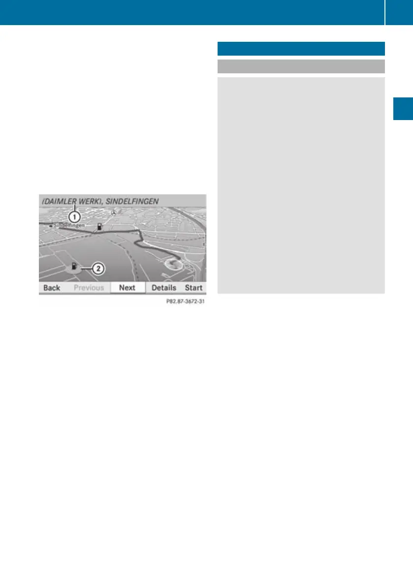
:
Information aboutthe highlighted special
destination
;
Highlighted special destination
X
To selectaspecial destination: select
Next or Previous.
X
To display details about the selection:
select Details.
i
The option is available if not all informa-
tion on the selected special destination can
be displayed in :.
X
To start route calculation: select Start
(Y page 101).
Aprompt appears asking whetherthe spe-
cial destination should be used as the des-
tination.
X
Select Yes or No.
If you select Yes, route calculation begins.
If you select No, you can select a new spe-
cial destination.
Navigation system (route guidance)
General notes
G
Risk of accident
COMAND calculates the route to the destina-
tion without taking account of the following,
for example:
R
traffic lights
R
stop and give way signs
R
parking or stopping restrictions
R
lane narrowing
R
other road and traffic rules and regulations
COMAND may give incorrect driving recom-
mendations if the data on the digital map does
not correspond to the actual conditions, e.g.
the road layouthas changed.
For this reason, you must always observe the
respective road and traffic rules and regula-
tions during your journey. Road and traffic
rules and regulations always have priority
oversystem driving recommendations.
COMAND guides you to your destination by
means of navigation commands in the form
of audible navigation announcements and
route guidance displays.
i
The route guidance displays can only be
seenifthe display is switched to navigation
mode.
If, for any reason, you do not follow the navi-
gation announcements or if you leave the cal-
culated route, COMAND automatically calcu-
lates a new route to the destination.
If the map data contains the relevant infor-
mation, COMAND tries to avoid roads that
only have limited access, e.g. roads closed to
through traffic and non-residents.
Roads that have time restrictions (e.g. closed
on Sundays or publicholidays) are not taken
into account for route guidance unless the
digital map contains the relevant information.
Navigation system (route guidance)
111
COMAND APS
BA 197 ECE RE 2010/6a; 1; 2, en-GB
sabbaeu Version: 3.0.3.6
2010-05-07T14:19:43+02:00 - Seite 111
Z

 Loading...