15.13Chartpresentation
Thecharthasanumberofpresentationoptionswhichaffectthe
levelofdetail,typesofobjectsandaspectsofitsoperation.
Thepresentationoptionsavailableare:
•Chartdetail—Setthelevelofobjectdetailshownonthe
chart.
•Layers—Setcontentlayerswhichcanbeoverlaid.
•ChartView—T oggle2Dand3Dperspectiveview.
•2DChartUse—Selectshingcharts(ifsupportedbyyour
chosenchartsupplier)orstandardnavigation.
•ChartOrientation—Settheorientationofthechart
application.
•MotionMode—Setthemotionmodeforthechartapplication
(onlyavailablein2Dview).
•VesselOffset—Setthevesseloffsetfromthecentreofthe
screen(onlyavailablein2Dview).
•ChartSync—Synchronizetheradarandchartscales.
•DataOverlaySet-up—Enabledatacellsinthechart
application.
Accessingchartpresentationoptions
Fromthechartapplication:
1.SelectMenu.
2.SelectPresentation.
Chartdetail
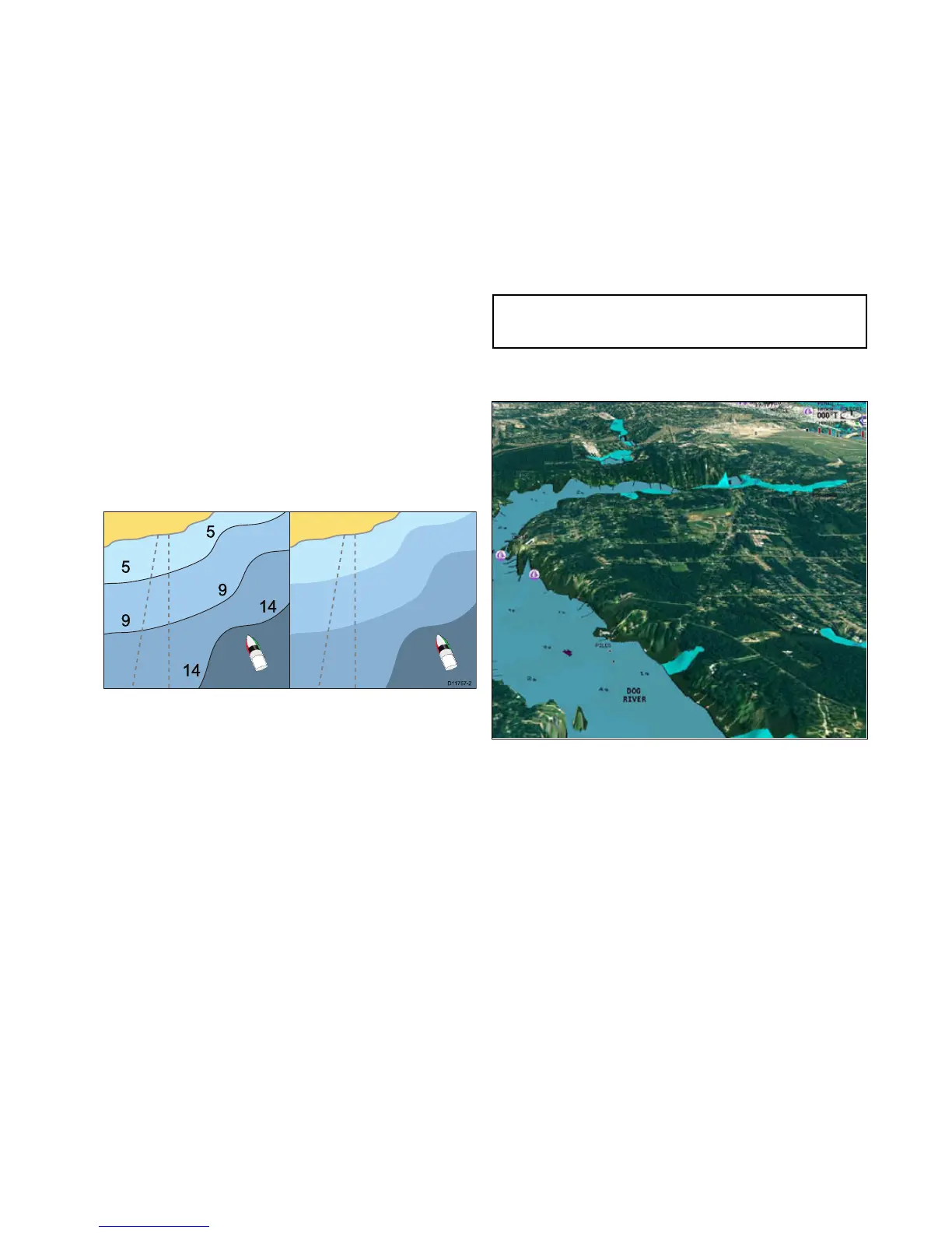
Thechartdetailsettingdeterminestheamountofcartographic
detailshowninthechartapplication.
SelectingtheLowoptionfortheChartDetailhidesthefollowing
cartographicobjects:
•T ext.
•Chartboundaries.
•Spotsoundings.
•Depthcontours.
•Lightsectors.
•CautionandroutingData.
•Landandmarinefeatures.
•Businessservices(ifavailableforyourchartcard).
SelectingtheHighoptionshowstheseobjects.
Changingthelevelofchartdetail
Fromthechartapplication:
1.SelectMenu.
2.SelectPresentation.
3.SelectChartDetailtoswitchbetweentheHighorLow
option,asappropriate.
Chartlayers
Thecharthasanumberofcontentlayersprovidingdifferent
kindsofdisplayandinformation.
Youcanoverlaythefollowingdataontoa2Dchartwindowto
givegreaterdepthofinformation.Theoverlaysavailableare:
•Aerial—Providesanaerial/satellitephotographyoverlay.
•AIS—ViewandtrackAIStargets(2Dviewonly).
•Radar—Overlayradarontothechart(2Dviewonly).
•NOWRad—ProvidestheNOWRadweatherradaroverlay,
withouttheneedtoopenaseparateweatherapplication
window(2Dviewonly).
•DisplayMyData—Allowsyoutoselectwhichwaypoints,
routesandtrackstodisplay.
•Vectors—ViewheadingandCOGvectorsortideandwind
arrows(2Dviewonly).
•RangeRings—Viewradarrangerings(2Dviewonly).
•SafeZoneRing—Viewsafezonering(2Dviewonly).
•FuelRangeRing—Viewthefuelrangering(2Dviewonly).
•3DDisplayOptions—Provides3Doptions:CentreofView,
Exaggeration,TransducerConeandDepthScale(3Dview
only).
Note:Thelayersrequireelectronicchartswiththeappropriate
featuresupportandmayalsorequireadditionalhardwareand
servicesubscriptions.
Aerialphotooverlay
Yourelectronicchartsmayincludeaerialphotography.
Aerialphotoscoverthenavigablewatersupto3milesinsidethe
coastline.Theresolutionisdependentontheregioncovered
bythechartcard.
Enablingaerialphotooverlay
Fromthechartapplication:
1.SelectMenu.
2.SelectPresentation.
3.SelectLayers.
4.SelectAerial.
Theaerialopacitysliderbarcontrolisdisplayedshowingthe
currentopacitypercentage.
5.Adjustthesliderbartotherequiredopacity,or
6.SelectOfftoturntheaerialoverlayoff.
Specifyingtheaerialoverlayarea
Fromthechartapplication.
1.SelectMenu.
2.SelectSet-up.
3.SelectCartography.
4.SelectAerialOverlay.
Alistofoverlayoptionsisdisplayed.
5.SelecteitherOnLand,OnLandandShallows,orOnLand
andSea.
Atickisdisplayednexttotheoptionandifaerialoverlayis
switchedonthescreenisredrawnshowingthenewoverlay
selection.
Chartapplication
151

 Loading...


